|
 |
Oahu
Thursday, May 24,
two days
before trip begins:
Rick and Marla Explore
Honolulu and the Island of Oahu
|
|
Marla
McStarla
Let's get one concept clear from the start -
Marla is the brains of our travel operation.
Now it is true I help a little bit. For example, I carry the
luggage, take pictures, and make snappy comments along the way.
But my role is completely secondary to Marla's. I need to make this clear
because after people read my stories, many readers assume I did all
the work. They come up to me at the studio and accidentally
give me all the credit. This is a misconception. The
credit should go to Marla for her incredible job of organizing one
great trip after another.
This amazing trip was
Marla's idea. Give all credit to her.
Our Hawaii Trip went off like clockwork thanks to Marla's hard work
and ability. If you people had the slightest idea how many
times a day Marla spent on the phone, the Internet and the
email program getting all the details right, you would be just as
much in awe of Marla's skills as I am. This woman is the most
thorough person I have ever met. Marla has a gift for
organizing trips. We are blessed to have her.
That said, there is an old saying -
Beware the man who praises intelligent women; he is planning to go
along for the ride.
When it comes to me and travel, I
just show up for the trip and let Marla tell me what to do. My grasshopper strategy
works like a charm. All sorts of miracles appear on a daily basis.
We get to the airport on time. We have a car waiting for us at
our destination. Then we have a beautiful hotel waiting for us
and a map magically appears showing me how to get there. Once
we get to the hotel, a list of places to visit appears along with
more maps. I barely
even have to think. I cannot tell you what a luxury it is to
be married to a travel genius. I am a lucky boy.
|
 |
 |
So that pretty much sums up my input into our
Hawaii trip.
Not only did we arrive in Honolulu without a hitch, Marla had each
day of the trip mapped out ahead of time.
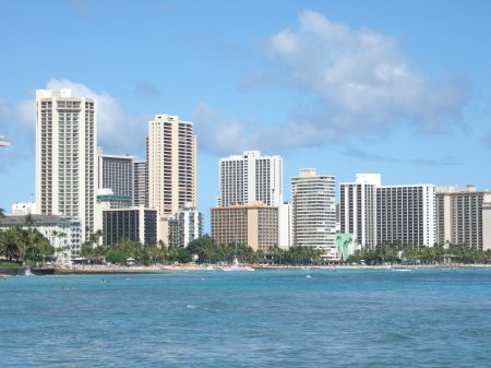
We arrived in Honolulu on Thursday, May 24. This was two days
ahead of our Saturday cruise. We came early so we could look
around and overcome jet lag in the process. Our first order of
business was to take a walk along the famous Waikiki Beach.
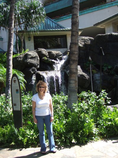
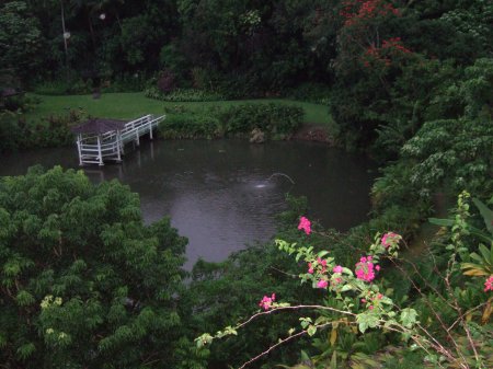
On our way to the beach, one of the most impressive places we passed was an entire shopping complex
wrapped around the Hilton Hotel. The Hilton is just one of
many incredibly luxurious hotels that line Waikiki Beach, but I have
to say I particularly enjoyed their elegant landscaping. The lush tropical foliage,
waterfalls and lagoons made this area a very attractive place to
visit.
|
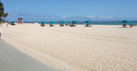
As we walked through
the Hilton Jungle, suddenly the famous Waikiki Beach came into view.
You might notice a walkway at the edge of this picture.
This walkway extends about three miles all along Waikiki. Just
as the postcards suggest, there were countless surfers testing the
waves. And as the postcards suggest, there were many beautiful
bikini-clad women along the shores.
Sorry to say I have no pictures to prove my point. I
know you guys are disappointed, but as
Marla and I strode hand in hand, I thought it would be disrespectful to
take photographs. Oh well.
|
 |
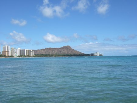 |
Looming in the distance was the magnificent
Diamondhead.
Marla told me we were scheduled to climb Diamondhead on Friday
tomorrow. I smiled because I like to climb mountains... or
maybe I should say I like to 'hike' mountains.
At any rate, seeing Diamond from the distance heightened my
anticipation. It looked like a fun adventure.
Little did I know that I
would suffer a huge personal embarrassment at the hands of
Diamondhead.
We will get to that story shortly enough.
|
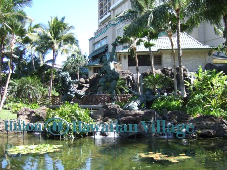
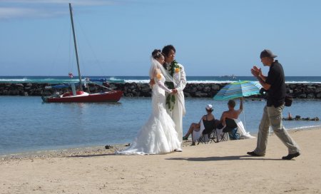
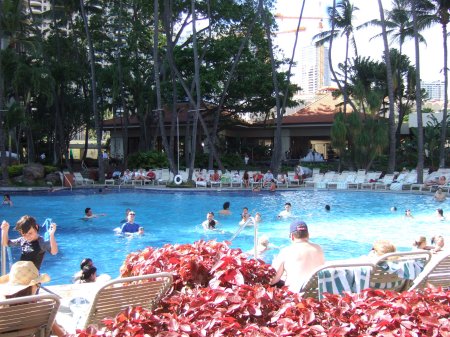
One thing I was surprised to find is the number of open-air
settings. For example, a main lobby of the Hilton was missing
a wall. One side had no
doorway! No doors, no windows, no nothing. I was
stunned. The constant 70 degree temperature and the total
absence of bugs makes walls unnecessary. I saw wedding
chapels designed with one open wall as well.
Here you can see an Asian couple preparing to have their pictures
taken. Marla and I saw a half-dozen wedding couples on our
stroll including an open air wedding in a lovely Hilton area visible
to anyone who wished to watch from a distance. Hawaii is a favorite destination for wedding
couples. I can see why - it is a very romantic setting.
|
 |
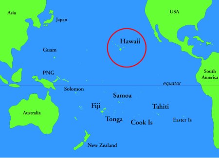 |
I was surprised to find that over 60% of
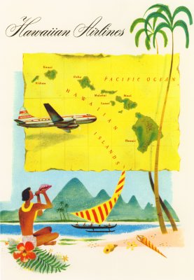
Honolulu's population was Asian. If you look on the map, it
turns that Hawaii is almost as close to Japan as it is to the United
States.
Hawaii really isn't close to any other major islands, but it
does seem to be in the middle of everything. Four continents
are within a reasonable plane flight. As a result,
everyone likes to visit Hawaii! I discovered Hawaii is considered just
as much a place for Chinese, Filipinos, Japanese and even
Australians to take vacations as it is for US citizens like myself.
While Marla and I ate lunch in one of the many open air
restaurants that line Waikiki Beach, I asked several people where I
would land if I took a boat due east from Oahu. Not one person
knew the answer (note: most Americans aren't very good at
geography). Most people had me landing in Los Angeles, but the
truth is that Hawaii is on the same longitude as Hong Kong, Mexico
City, Cozumel and Cuba.
|
|
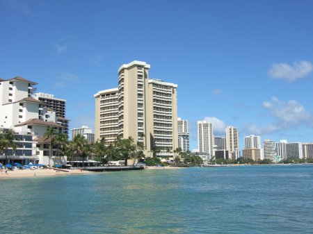
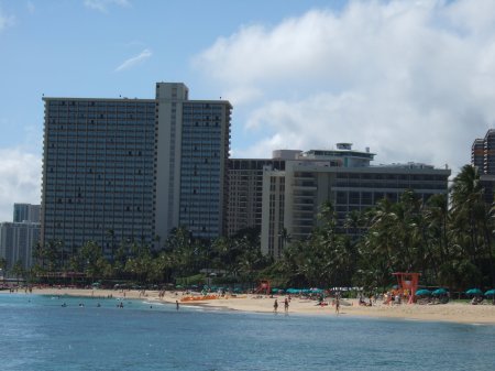
As Marla and I walked along
Waikiki, it was hard not to be
impressed by all the spectacular hotels.
|
What a view.
|
|
I was able to walk out on a long fishing pier
and get some pictures of Waikiki Beach from out in the water.
|
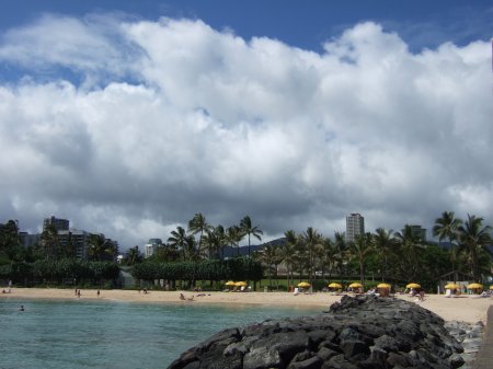
As you can see, the beach wasn't all too
crowded.
|
|
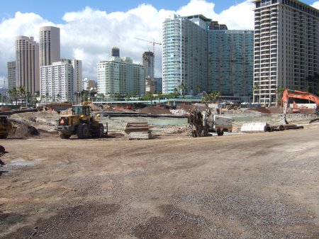
There wasn't a lot of new
construction in Honolulu,
but obviously a monster new hotel is about to take its place next to the other Waikiki Beach giants.
|
Everything along Hotel Row on Waikiki was so
pretty. There was one lovely picture after another waiting to
be snapped.
|
|
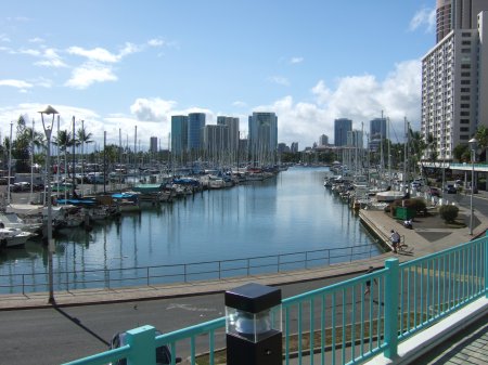
Our hotel was right next to a "Yacht Harbor".
There were some very impressive boats moored in this area.
|
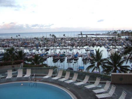
Sometimes it was really hard not
to be envious
of the people who live in Hawaii.
|
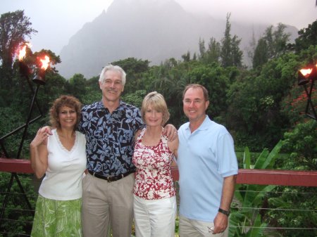
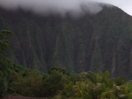
Glenn and Paula at Kaneohe
Thursday evening had a marvelous treat awaiting
Marla and I. Our friends Glen and Paula Morris had invited us
to have dinner with them. Like us, Glen and Paula also came to Hawaii early to get a better feel for
the place. But Glen and Paula went one step further - they had
rented a condo in the nearby town of Kaneohe.
Their condo presented them with a perfect view of the ocean and the
harbor. What beauty!
In addition, Glen and Paula had been able to reconnoiter the area
and they discovered a gem - the most beautiful restaurant that I
have ever been to!
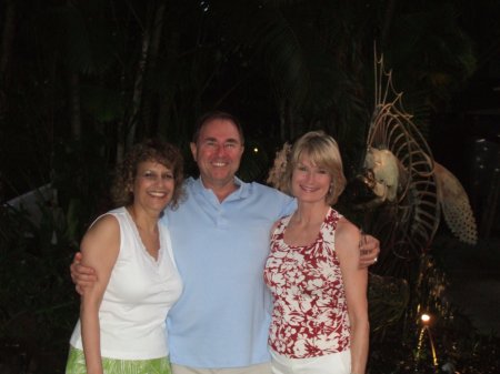
Here's one picture of the lush scenery at this lovely restaurant.
Now I know you are going to want to know the name of the place, but
I can't remember. Honest. I think the name was
"Haiku Gardens".
|
 |
 |
As Marla and I drove from Honolulu to Kaneohe, we
were treated to an unusual phenomenon - the dry side and the rainy
side of the mountains.
Hawaiian mountains are famous rain catchers. It is almost like
they tickle the rain clouds as they pass over and make the heavens
pour.
The dry side is on the west (left side of the map). For
example, Honolulu was a dry as a bone. But once
we got up in those mountains, watch out. It was pouring rain
as we drove through a mountain pass as we took the short cut to
Kaneohe!
Once we got to the east side of the mountains we were startled to
see the lush vegetation. Kaneohe is located in the middle of a
tropical rain forest. It was just as green as it could be.
It was so weird... an arid California-style brown prairie on one side, an
Oregon-style rain forest on the other... and the mountains are only
about ten miles wide.
|
|
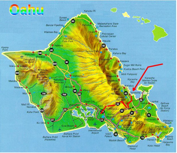
Here's a good look at the rainy side of Oahu.
The beauty was just stunning. That mist was awesome.
|
Marla with Glen and Paula.
|
|
Here are some pictures taken from our
restaurant. As you can see, the restaurant had a private lake.
See those mist-lined mountains in the background? Stunning.
|
The owners did the landscaping themselves,
but God was kind enough to provide the incredible mountains in the
background.
This place was quite beautiful.
|
|
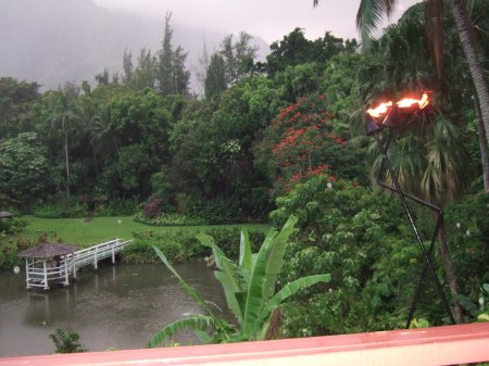
The restaurant was about twenty five feet
above the lake. I took this picture from the railing above.
Not surprisingly, this place does an active wedding business.
See the gazebo on the edge of the lake? That's a favorite spot
for the "I Do's". There is a reception building concealed in
the trees nearby.
|
This was an open air restaurant. There
was no barrier between the diners and the spacious gardens in the
valley below. I kept wondering when the mosquitoes were going
to strike, but none appeared. The temperature was a perfect 72
degrees and a gentle breeze came in. I don't think it is fair
to be forced to come back to Houston weather after a visit to
Hawaii.
|
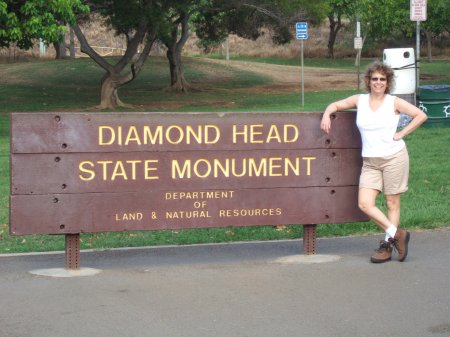
Friday, June
25, one day
before Day One:
Rick and Marla's Adventure at Diamondhead
|
|
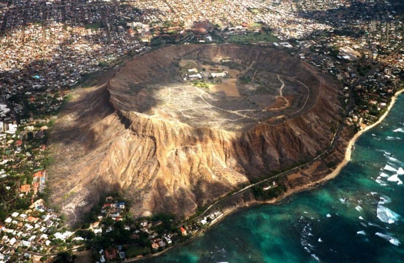 |
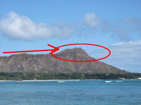
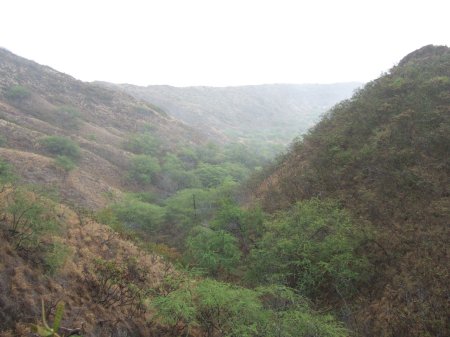
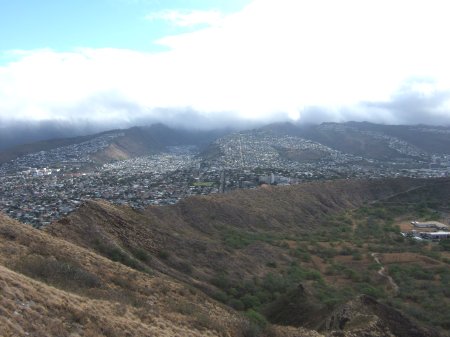
One event I had really been looking forward to
was our chance to climb Diamondhead.
Diamondhead is easily the
most recognizable landmark in all the Hawaiian Islands. I couldn't wait for my
chance to see the stunning crater of this gigantic extinct volcano.
I mean, just look at the picture - this crater is huge! You
could land an airplane in there easily!
Friday morning had Diamondhead penciled in as our first big
activity. I was going to climb up the mountain and look down
at the massive crater below. Oh boy!
Little did I suspect that I was going to end up feeling very foolish
at the end of our adventure.
Before we go any further into this goofy tale, let's have a look
below at the picture of the crater that was in my mind's eye BEFORE
THE DAY BEGAN.
I
had seen pictures of the crater before the trip and was full of
anticipation to see it first-hand.
That's some crater, huh?
|
Now for this story of my overwhelming stupidity to make any
sense, you have to understand what I thought was going on.
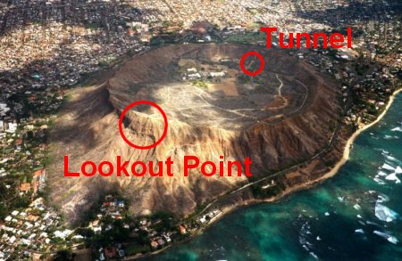
I assumed the peak of Diamondhead was where the crater was located
(red circle).
I also assumed that we would walk up the mountain along the lines of
the arrow pointing to the eastern tip, get to the top, and be able
to look down into the crater.
As we drove to Diamondhead that morning, my suspicions were
confirmed. We were forced to drive a long way to the west to
about the same area where that red arrow would begin.
After some winding roads in the Diamondhead foothills, we saw a sign
announcing we had found the park. We drove through a short
tunnel and there was the peak of Diamondhead before me. Wow! I was really excited. Let's
climb up there and see that crater!
So we started climbing. And climb we did. And climb.
And climb. And climb some more...
|
 |
|
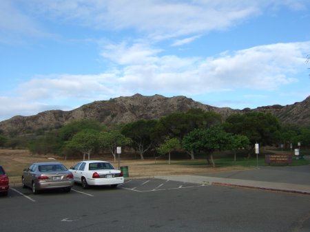
Here's the parking lot. There's the
mountain.
Surely the crater is on the other side.
|
Marla was looking forward to the climb as
well.
|
|
That is the first stage of the Diamondhead Mountain in front of
us. I couldn't wait to see that crater on the other side once
we got to the top!
|
Here's the rolling valley behind us.
This picture shows part of the area from where we started our climb.
|
Those buildings below are next to the
parking lot. This was a serious twisty windy trail.
|
In case you are wondering, I took
these pictures on the way back. You can see Honolulu far away
in the distance.
|
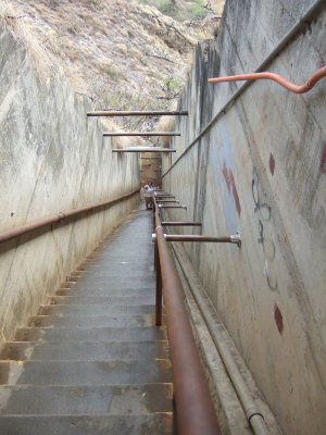
Let me tell you something - those
steps were steep! There was some serious breathing here.
|
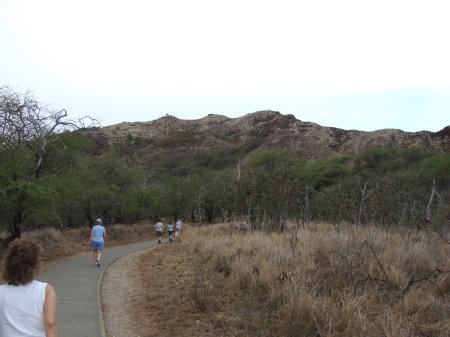
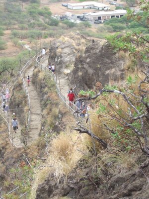
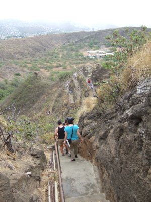
After a long hike from the parking lot, we finally got to the
base of Diamondhead. That's when Marla and I started climbing
a long winding path. The trail was very crowded. There
were people coming and going in every direction.
A couple of funny things happened to me during my climb. As we climbed the
windy twisty part, my cell phone rang. It was a friend of mine from
Houston calling on my cell phone to ask if we were playing
basketball that weekend.
Here I was two thousand miles from home on the top of a mountain and
I was getting a free long distance call from Houston. I
assured my friend that the gym back in Houston was indeed open, but that I probably
wouldn't be there.
About this time my body was getting pretty tired from this
long, arduous climb. Here I am huffing and puffing and
plodding along feeling pretty sorry for myself when somebody came
RUNNING past me! When I say 'running', I mean this man
was literally sprinting up the mountain! Not 'climbing fast',
but SPRINTING.
As I stood there in shock watching the human blur become smaller in the
distance, a man walking nearby
saw my shock and took pity on me. He explained I had just been passed by a local Triathlete
out on a morning training jog.
It turns out this is the land of the Ironman Triathlon. Held
every Fall at Kona over on the Big Island, the race encompasses three endurance
events - a 2.4 mile ocean swim in Kailua-Kona Bay, a
112 mile bike ride across the Hawaiian lava desert to Hawaii and back,
and finally a 26 mile Marathon along the coast of the Big
Island. Mind you, most people consider the Marathon to be the
most grueling event of their lives, but this event tacks on swimming
and cycling as well!
This triathlete person was a Superman.
I was in awe.
|
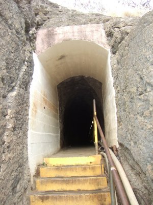
This tunnel is at the top of the
long steep steps.
|
|
So finally we got to the top. That was
one long climb!
I was super-proud of myself for making it all the way up here.
Unfortunately my good vibes disappeared when we ran into our friends
Cathy & CA Riser.
|
Cathy explained to me they walked all the way
from their hotel. These people walked TWICE the distance I had, but they weren't even breathing heavy! I smiled and
pretended I was happy for them, but it wasn't easy.
|
|
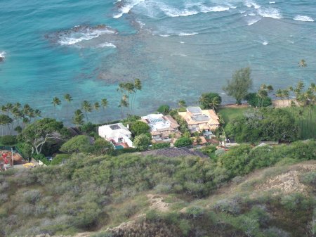
I looked down below and stared in unabated envy
at the
homes of the rich and famous.
|
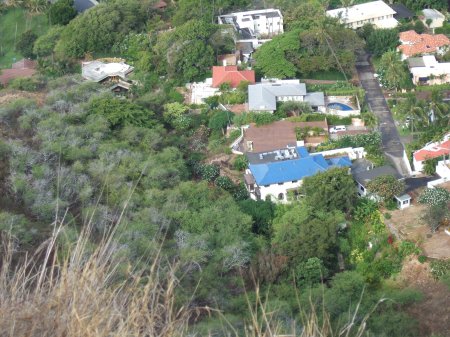
They say money doesn't buy happiness, but I
grow increasingly suspicious of that adage. I think the people
in those homes are happy to be here.
|
|
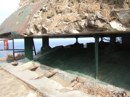
It turned out that the area at the top
was once a military installation. After climbing through a long tunnel carved deep into the mountain,
we emerged at this pillbox area where the long guns of this mountain
fortress were once housed. Shades of the Guns of Navarone.
|
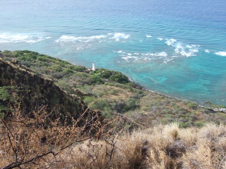
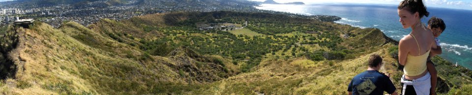
Diamondhead is famous as a lookout post
because you can see everywhere in four directions. Now it's time to see the sights. First I
looked south. That lighthouse should give you a good idea how
high we were.
|
|
Then I looked west. There is beautiful
Honolulu in the distance.
|
Then I looked north. More Honolulu.
|
|
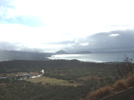
Then I looked east. That's Koko
Head way off in the distance. The famous Hanauma Bay
is out of sight, but it is just beyond the other side of Koko Head.
|
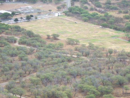
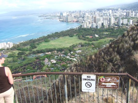
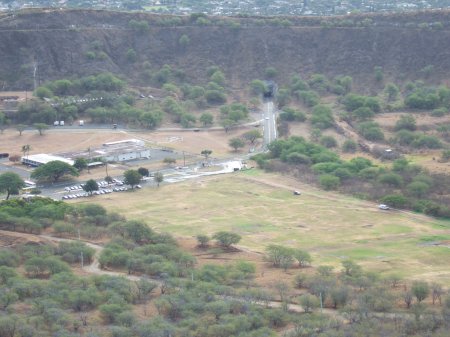
Then I looked back at our parking lot.
Down below is the area where we started. Something was really
bothering me.
Where was that volcano crater hiding?
|
I had finished looking in all four directions and there wasn't any sign of
a crater!
I was so angry! I continued to turn and turn and turn
looking for the crater. I couldn't figure it out.
Finally I blurted out to Marla, "Where's the damn crater?"
Marla looked at me with a strange expression. Finally
she realized I was not pulling her leg. I was completely
disoriented!
Marla pointed back to the area we had come from and said, "Our car
is parked in the crater."
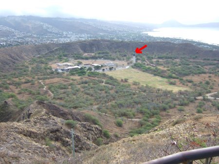
What? I looked back down into the valley. I stared at the valley in confusion. It took me a long time, but slowly
the realization crept over me that those hills at the edge of the
valley were "connected". Could those hills be the rim of the crater? Far off in the
distance I noticed a little hole in the side of the hill. If
you look at the red arrow, you should be able to see it.
I got out my binoculars to get a better look. Ohmigosh, is that
hole really what I think it is? Sure enough, that hole
was the tunnel we had driven through to enter the crater.
The creepiest feeling came over me. That's when I began to
feel like the biggest moron that ever walked the earth. I had
not felt this stupid since the surprise ending of the Sixth
Sense movie. I had been looking high and low for the
crater only to find I had been standing in it all morning long.
And how exactly did I miss seeing the crater from the start? My
mistake was assuming the crater was on the 'other' side of the tall
Lookout Point. I
was so convinced that the crater was on the far side of the
mountain I was climbing that it never once dawned on me the area behind me
was the actual crater.
I was also fooled by the
fact that the circular rim of the crater was not symmetrical in
height.
Three quarters of the rim was not particularly high. In fact,
the majority of the rim was so low I thought I was looking at hills.
Plus it never dawned on me a crater could have trees. I knew I was in some sort of
plain, but I was too stuck in
my mindset. I would look to my right in the plain and see a
hill. I would look to the left and see a hill. But not
once did I notice that the different hills were completely connected
all the way around! It was a 'can't see the forest for
the trees' sort of thing. That crater was so big I
didn't even begin to realize what I was looking at!
The sky-high Lookout
Point on the other hand was five times taller than the rest of the
rim. I was so convinced the crater was on the 'other side' of
Lookout Point that I wasn't interested in looking at anything behind
me. So I never looked back during the climb. Too bad.
Maybe if I had looked back I would have noticed a mammoth crater
sneaking up behind me.
So now you know the pathetic story of how a massive crater
two miles in diameter and a
mile wide managed to hide in plain sight from Rick for over two
hours.
Duh. Just call me Mr. Magoo.
|
 |
|
 |
|
Saturday, Day One:
Hanauma Bay
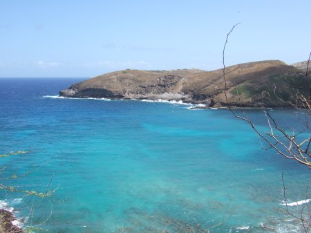
Hanauma Bay
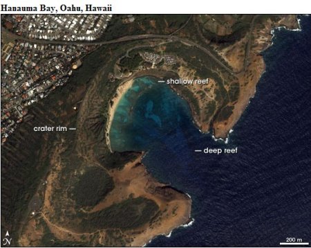
is a marvelous beach area located just beyond the outskirts of
Honolulu. The first thing you notice when you see the bay is
just how 'curved' the bay is. After my experience with
Diamondhead, I now had the nerve to consider myself some sort of expert on
volcanoes. I immediately suspected that Hanauma Bay's unusual
C-shape had something to do with a volcano.
Sure enough, the Bay occupies the location of a volcanic crater that
had one of its sides eroded by the ocean. Think of a bowl that
has one side broken and you will get a rough idea of what the Bay
looks like. Realizing that my writing skills probably were
insufficient to explain the phenomenon fully, I went to the Internet
and found exactly the picture I was looking for in about 15 seconds.
Isn't the Internet amazing?
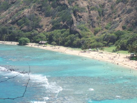
Hanauma Bay is a precious resource to the Hawaiians. Due to
the protected waters, over the eons this area has developed a
marvelous coral reef that has become home to many varieties of fish.
All you have to do is put on your snorkel gear and swim out there.
Ten feet from the beach you will be treated to an incredible display
of sea life. According to a pamphlet I picked up, the Bay is
home to a rainbow of reef inhabitants such as tangs, parrotfish,
butterfly fish, moorish idols, surgeonfish and more. In
addition, Hanauma Bay is frequently visited by the protected sea
turtles.
Long considered one of America's Top Ten Beaches, Hanauma Bay is
visited by 3,000 people a day. As you might guess, this puts
enormous pressure on the ecosystem of the Bay. This has forced
the implementation of conservation measures. For example,
parking and access to the beach is controlled (we saw three guards
at the entrance!) The feeding of fish, once a favorite
activity, is now strictly prohibited.
The most unusual feature of the preservation effort is a 15-minute
long video that all visitors are forced to watch before entering the
beach area. The video explains how to
protect the fragile
living reef. After the video, volunteer speakers
further educate
visitors so that additional damage to the preserve�s environment can
be avoided.
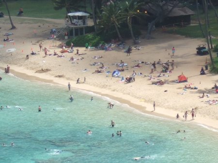
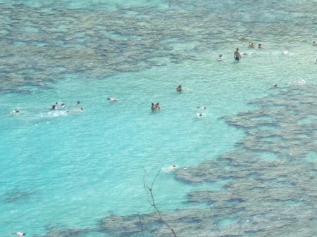
The video was actually quite effective. Marla and I visited
Hanauma Bay early Saturday morning to try some snorkeling.
After seeing the video, I could barely step on a rock without
feeling guilt for the rest of the morning.
Other than my crushing fear of doing something stupid and
single-handedly destroying the entire eco-system, I had a lovely time
seeing the many varieties of fish.
The highlight of my morning was getting to witness
a
mating dance between two tangs underwater... now I know exactly what
they mean when they say it takes two tangs to tango.
|
 |
 |
 |
|
Saturday,
Day One:
The Hawaii Cruise Begins
|

Gary and Cheryl Davis on left, Tracy
Kirkland and Mr. Hat Gary Schweinle,
Gay Anseman in front, MG in back, and Sherry Thornton
|
Saturday was the third day here in Hawaii for Rick and Marla.
Like us, many people had arrived early.
Now it was time for the cruise to begin.
After getting settled in our cabin, I went around looking for
members of our group.
The first place to check is ALWAYS the casual dining room. Sure enough, I
found several of the Usual Suspects finishing up an afternoon snack.
I continued to wander around the ship. Here
are some more pictures.
|
|
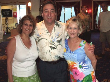
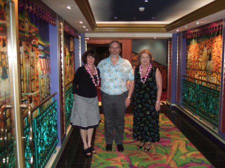
Marla with Jim
and Denise Duncan.
|
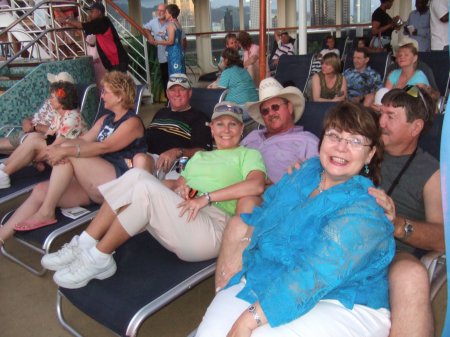
Cheryl, Gary
Davis, Tracy, Gary Schweinle, Gaye and MG Anseman
|
|

This is Leroy Ginzel
|
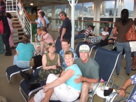
Linda Fleischer & Wayne
Corbett, Fran Zandstra & Gus Donnell
|
|
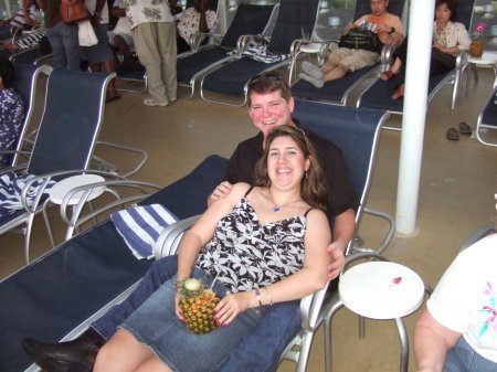
Mike Shannon and Gina Garza |
That's Sherry again with Doug Gephart
and Nancy Schweinle |
|
|