Creating the Canal 1
Written by Rick Archer
October 2011
|
 |
Creating the Panama Canal
Have you ever wondered how
they made the Panama Canal? Most people - and that
includes me - assumed they dug an enormous 50 mile trench
across the Isthmus of Panama. In fact, that was the
original plan - dig dig dig till the oceans connected.
Call it the "French Connection".
Many people do
not realize the French tried first. The French began work on a Panama Canal of their own back in
1880. They stayed with the project for 10 years until they
gave up in utter futility. The Americans had been
following the progress of the French closely. The USA
wanted that canal built in the worst way. But if they
took over the project, could they do any better?
When it was
proposed to build the Panama Canal there were those who
believed it was possible to cut down the backbone of the
Cordilleras until the waters of the oceans could sweep
through unhindered to a depth which even at low tide would
carry the largest steamship afloat. The "Dig Down"
concept was at the core of the French Connection Plan.
There were
others who held that a more feasible plan would be to lift
up the waters. This alternative plan was to raise the waters in
the middle of Panama to an
elevation as high as 85 above sea level. Then they
would lift the ships
to meet them using a lock system. The latter idea prevailed.
The American people owe their
triumph at Panama to this bold gamble.
|
 |
The
French Plan... aka Dig Dig Dig... had called for
excavating the entire 50 mile stretch.
The Americans
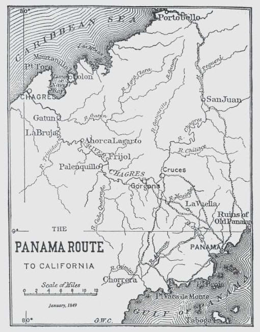
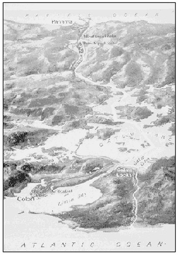
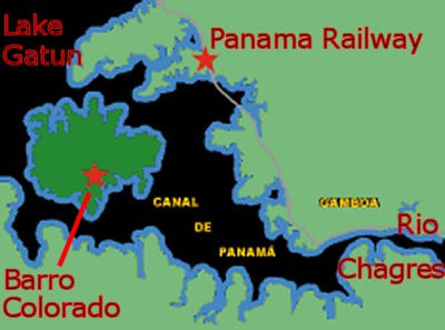
proposed to connect the bend in the Rio Chagres
(see map) with
the Miraflores Lake by creating a giant gap in the
mountains. The American "Raise the Waters" plan
meant they only had to dig about one-fifth of the
way... 10 miles or so.
After
that, the Americans would raise the waters.
What exactly did that mean? How do you "raise
the waters"? Keep that in the back of your
mind; we will get to it later.
The
American plan was still a heck of a lot of work. They had to carve a gap
one-third of a mile wide and 120 feet deep through solid
mountain rock. It was the modern-day equivalent of
creating a replica of the Grand Canyon down in Panama.
The Grand Canyon took eons to create. How long would
it take humans to do it and was it even
possible?
In this case, it
really was nearly impossible. The time, effort and
expense involved turned out to be so great that the
engineers said afterwards they would have never attempted
the project had they known its difficulty in advance.
But try they did. And once they got into the project,
they were determined not to fail.
|
|
|
STAGE ONE -
THE BIG DITCH
|
In addition to its thick
jungle, Panama is extremely rugged. Panama has no giant
mountains like the Andes, but has plenty of mini-mountains and very large hills.
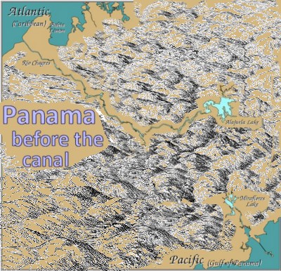
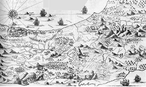
The major river of
Panama is known as Rio Chagres (find it on the map). You
can see the Chagres River is much closer to the Pacific Ocean than
the Atlantic.
However, since the Chagres is on the Atlantic side of the
Continental Divide, like the Amazon it is forced to take the longer
route to the Caribbean side.
What the engineers proposed to do
was dig out the 10 mile stretch between the bend in the Chagres at
Gamboa and
connect it to Miraflores Lake on the other side of the
Continental Divide.
There is a mountain
chain that runs through Central America that connects the Rocky
Mountains to the Andes.
Fortunately Panama has
the lowest point on the chain, but the lowest point was still 360 feet above
sea level. Located directly over the Continental Divide, this
was solid rock. Cutting a gap through it wasn't going to be easy.
|
 |
 |
THE
CULEBRA CUT
In order to connect the Chagres River
to the Pacific Ocean, the engineers would have
to cut through solid rock at a small town known as Culebra
located right next to the Continental Divide.
"Culebra" is Spanish for
'snake'. At first the men speculated this term referred to the
zigzag path of the linked chain of hills. However, once the
rattlesnakes began to slide out of the jungle on a regular basis, there was
no more doubt where the name came from.
The engineers would have
about 10 miles of hills and rocks to deal with before they finished.
Of this ten mile
stretch, fortunately only one
mile required abnormally hard work - the stretch right along the
Continental Divide.
This difficult stretch was nicknamed the
Culebra Cut.
|
|
The entire 50 mile body
of water that crosses Panama is considered the "Panama Canal", but
it was this 10 mile stretch that involved the lion's share of the
work. It was a massive project.
The French had
tried to build a canal in this same spot starting
in 1880. Most of the hard work was done by blacks recruited
from impoverished Eastern Caribbean islands. Some of them
had been slaves as children while most were descendants of the slaves who
had worked the sugar plantations.
Little did those men
realize they were facing a death sentence. Over 22,000 men
would die from malaria and yellow fever. Sad to say, most of them
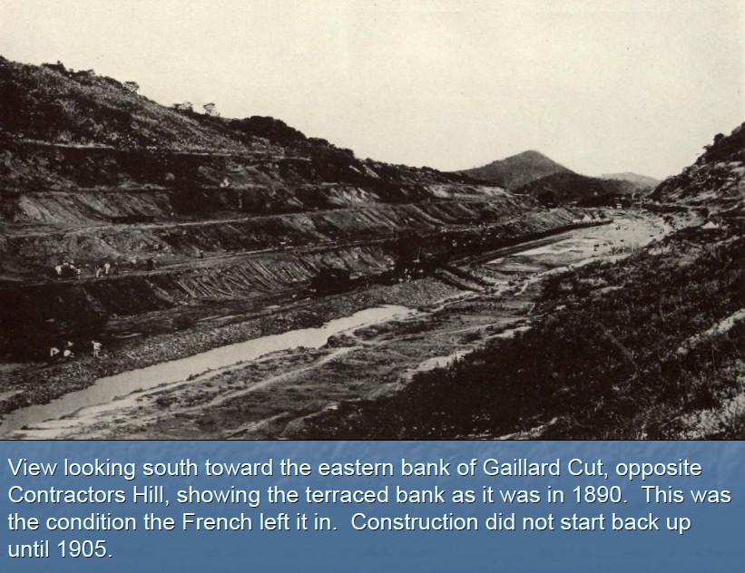
died in vain. The French got nowhere. In 1890, the
French threw in the towel.
The United States
took over in May 1904. The Americans started work
on a wider, but not so deep a cut. Unlike the French
who believed it was possible to create a canal at sea level, the
Americans had a new plan based on an elevated
lock-based canal.
Unfortunately,
both plans had the same obstacle: a hole had to made in the
mountain range.
|
Yes, man had dug
tunnels through massive mountains before. And yes, man
had widened existing gaps in mountains created by rivers to
build railroads and highways.
However, knocking
a gap through a mountain where there was no previous river
gap to work with was almost unthinkable.
Fortunately,
in the enormous mountain chain stretching from Alaska all
the way to Chile, there was one single point where the mountains
had conveniently turned into low-lying hills - Panama.
The lowest point
in the saddle between Gold Hill on the east and Contractors
Hill on the west was only 333 feet above sea level.
That is where the cut would go.
The depth wasn't
the biggest problem; it was the length. They would
have to cut through ten miles of rock. That was a
daunting task.
The always
cheerful American
press had a name for this 10 mile valley.
They called
it "The Big Ditch".
|
 |
|
 |
The new plan called for a bottom width of 300 feet. This
required the creation of a valley up to a third of a mile wide at
the top and eight miles long. The gap would have a vertical
distance from the bottom to top 120 feet deep.
That would call
for a lot of digging.
The Americans
had one huge advantage over the French - the French had
already done nearly half the work!
Of the entire 50
mile Panama Canal, the French had already started work on 11
of the miles. The Americans had a big job ahead of
them, but at least they weren't starting from scratch.
A vast amount of new
earthmoving equipment was imported and a comprehensive system of
railways was constructed for the removal of the immense amounts of
earthen and rocky spoil.
Major David du Bose Gaillard, U.S. Army Corps of Engineers, was put
in charge. Gaillard brought dedication and quiet, clear-sighted
leadership to this difficult, complex task.
|
|
|
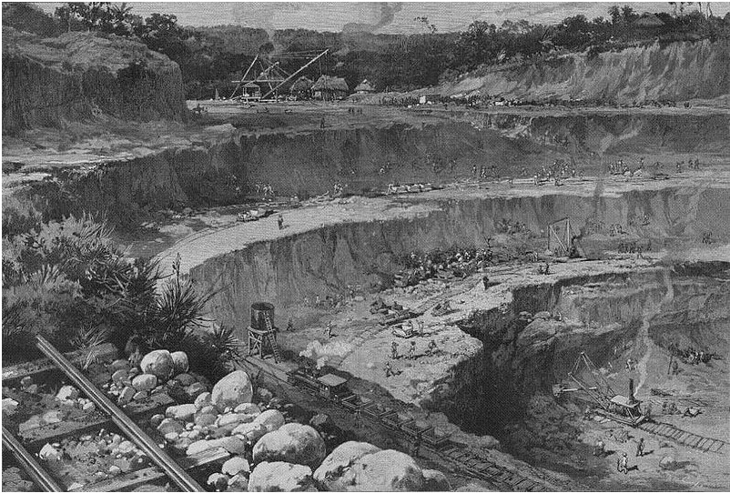
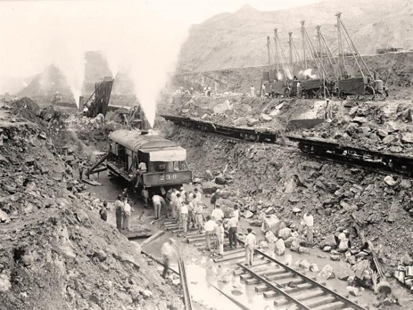
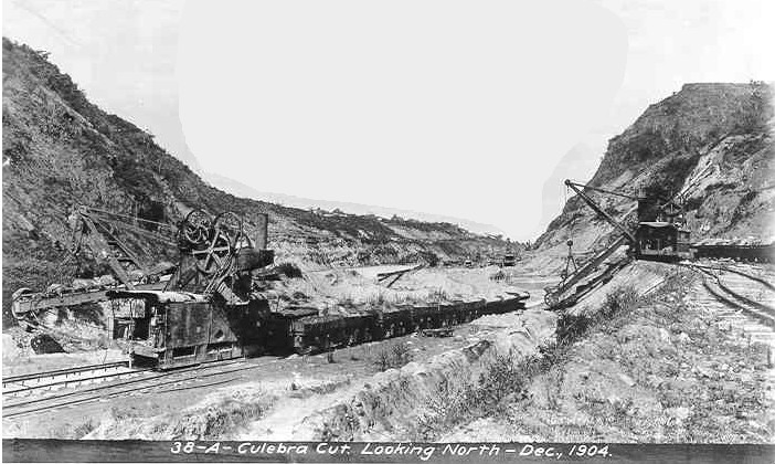
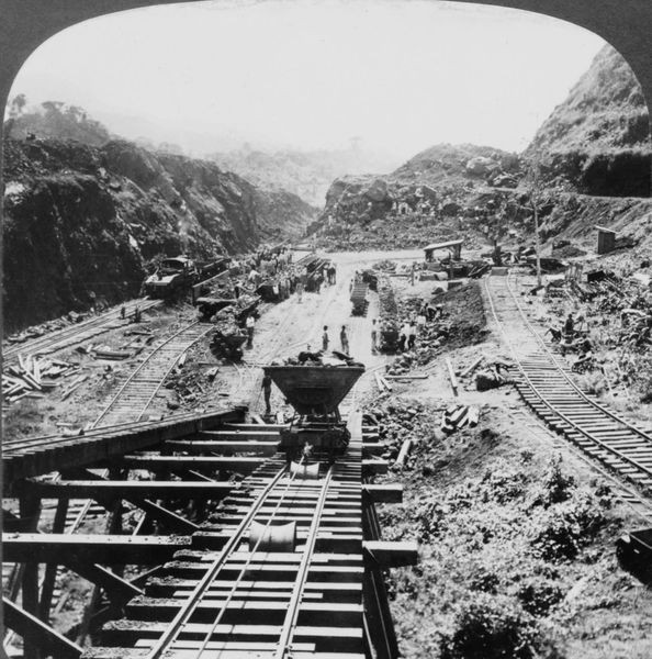
The scale of the work was massive. Hundreds of large steam drills
bored holes into the mountainside. Tons of dynamite were planted
were planted in these holes.
They blasted
the rock out and excavated it using steam shovels which transferred
it to trains. Dozens of trains took
the loose dirt and rock from the shovels to landfill dumps in the
Pacific Ocean
about twelve miles away.
Other trains took an
equally large amount to a project near the Gatun Locks which were
under construction.
In a typical day, 160
trainloads of material were hauled away from the 10-mile long valley
affectionately known as the "Big Ditch".
Actually, there probably
wasn't much affection involved. The work was incredibly
arduous. When it wasn't raining in cascades, it was miserably
hot.
|
 |
|
 |
At the busiest times,
there was a train going inbound or outbound almost every minute.
This meant the workload on the railroads required some skillful
co-ordination.
Six thousand men worked
in the cut, drilling holes, placing explosives, controlling steam
shovels and running the dirt trains. They also moved and extended
the railroad tracks as the work moved forward.
Twice a day work
stopped for blasting. After the blasting finished, the steam shovels moved in to
take the dirt and rock away and pile it into the trains. More than 600 holes filled with
dynamite were fired daily.
The excavation of the
cut was one of the greatest areas of uncertainty in the creation of
the canal. It could be dangerous. There were many unpredicted landslides caused by
destabilizing the pressure that had once compressed the loose dirt and rock on
both sides of the cut.
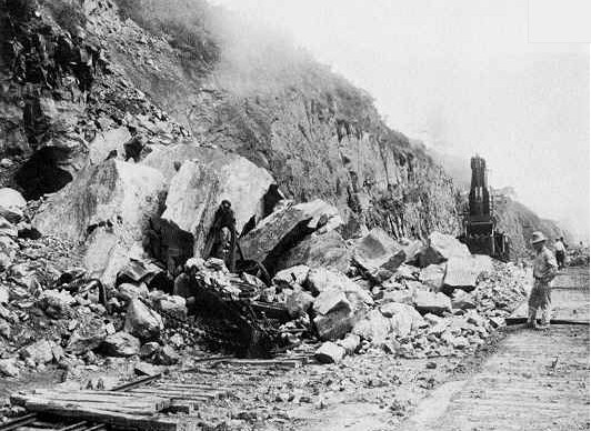
There were many minor
slides such as the rock slide pictured on the left. As
problems go, this was nothing compared to the gigantic mudslides.
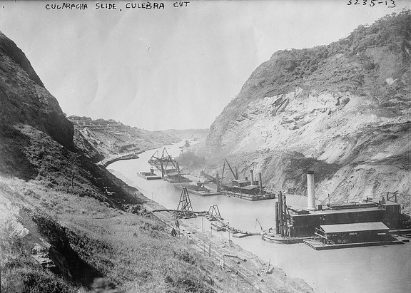
|
The first slide
was the worst. Known as the Cucaracha Slide, it
occurred in 1907. The initial crack was first noted on
October 4, 1907. Soon it was followed by the huge slide of
500,000 cubic yards of clay. Months of work was
destroyed overnight
The black and
white picture on the right doesn't lend itself to
understanding the problem very well, but let's try anyway.
One problem is that this picture was taken after some of the
damage had already been repaired.
The white area
on the side of the mountain is where the gigantic mud slide
broke away. The mud oozed and dispersed into the
channel. Those steam shovels had to excavate the slide
and start over.
Another
very destructive slide occurred in nearly the same place in
1912 when the canal was nearly complete.
Seventy-five
acres of dirt near the town of Culebra broke away. It
moved foot by foot into the canal, carrying hotels and club
houses with them down into the valley.
It took nearly half
a year to repair the damage.
|
 |
|
|
 |
Here are
four
different
views of
the 1912 landslide that
caused
so much consternation.
In the
picture on the left, the steam shovels appear to have
already made some progress clearing the area.
|
 |
|
|
 |
I added the red arrows to illustrate that you are seeing two
different angles of the same problem.
As you can see, at first the mud slide completely dammed the Canal.
|
 |
|
|
|
The first slide in 1907
caused many people to bring up the sore subject again that the
construction of the Panama Canal would be impossible. It was
such an enormous setback that the opponents of the Canal argued long
and hard that now was the time to acknowledge the entire project was sheer
folly and quit.
Gaillard was undeterred.
The big slide was a setback, but not a catastrophe.
He described the slides as "tropical glaciers". A glacier, of
course, is made of slow-moving ice. The Big Ditch slides were
made of mud instead of ice, but were just as disheartening. It
was painful to see so much work undone, but that was the risk they
took. When you loosen the
earth, it has a mind of its own.
The huge mounts of clay
were a tough problem because it was too soft to be excavated by the
steam shovels. Eventually Gaillard's engineers discovered the
clay could be removed by sluicing it with water from a high level.
The slides still
continued to cause minor problems after this, but the trick of
liquefying the clay had turned the corner.
Overall the Panama Canal
took ten years to finish. The delay caused by the various slides was estimated at two and a half years.
Nevertheless, even despite the delays, the work on the Big Ditch was
completed two years ahead of schedule. Much of
the credit was given to Gaillard's steady leadership.
In a sad twist of fate,
Gaillard died from a brain tumor in December 1913. He never
saw the opening of the canal a few months later in 1914.
The Culebra Cut, as it was originally known, was renamed to
the Gaillard Cut in 1915 in his honor. However, from
what I gather, the original name still continues to enjoy great
popularity, especially with those who speak Spanish. So
consider the Gaillard Cut to be its formal name, but the
Culebra Cut seems to be the nickname everyone uses.
Whatever the name, much of the credit deservedly goes to David
Gaillard.
The term "Culebra Cut"
specificially refers the toughest one mile cut at the Continental
Divide. However, over time, the term "Culebra Cut" has come to
also refer to the entire 10-mile valley from Gamboa to the Pedro
Miguel Locks once known as "The Big Ditch".
|
 |
 |
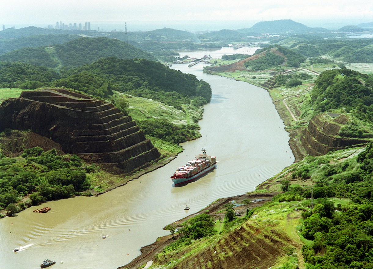 |
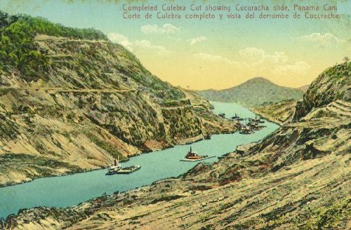
This is
the most dramatic part of the Culebra Cut. Notice the
Pedro Miguel Locks and Lake Miraflores in the background.
That is Panama City way in the back.
This image is so
serene that Cruisers looking up from water level are fooled.
They often by have no idea the amount of work
that went into cutting that gap. To them it just looks like
big hills on either side of the canal.
People exclaim, "Oh, look at
the cute little terraces! Wouldn't that be a pretty spot for a hanging garden?"
|
|
|

 |
RIO
CHAGRES
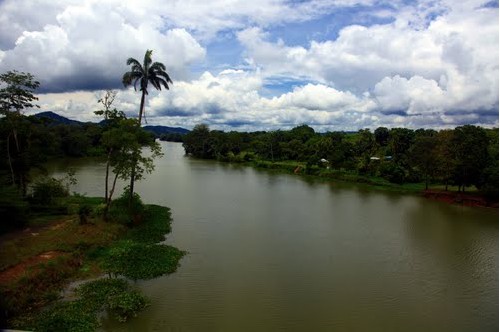
The Chagres is the
Mississippi River of Panama. It is 120 miles long and serves as the main escape
route to the ocean for much of Panama's rainwater.
But which ocean does it go to?
There is an enormous,
unbroken mountain chain in the Americas that starts up in Alaska,
continues through Canada and the US as the Rocky Mountains, on
through Central America, and then down through South America as the
Andes Mountains. It is sometimes called the "Cordillera of the
Americas", 'cordillera' being the Spanish term for "chain of
mountains" (actually that unbroken
chain is now broken for the first time thanks to the Culebra Cut, but you know what I mean).
The Continental Divide
is the name given to the mountainous highpoint that separates the water
systems that drain into
the Pacific Ocean from those river systems that drain into the
Atlantic Ocean (including those that drain into the Gulf of Mexico
and the Caribbean Sea).
For example, in the
United States, the majority of rivers head east due to the placement
of the Rockies in the west. But not all Rocky Mountain streams
head to the Mississippi River. The major exception is the
Colorado River. Located on the western side of the Continental
Divide, the Colorado River heads southwest towards the Pacific,
carving out the Grand Canyon along the way. Obviously some waters head
east while other waters head west. That's why it is called
"The Divide".
So what about the Rio
Chagres? Where does its water head... Pacific or Atlantic?
That is actually a very clever trivia question. Thanks to the
Culebra Cut, Rio Chagres is the only river in the world that empties
into two oceans.
But it wasn't always
that way.
The Chagres is on the eastern side of the Continental Divide, so its
original ocean of choice was the Atlantic.
The Chagres River is one
of the moodiest streams in the world. One day
it flows along as a peaceful, lazy little tropical river barely over
two feet deep in some places. It moves sleepily on its journey to the sea.
But watch out when it
rains! After
rainfall, the Chagres becomes a wild, raging torrent with waters 40 feet deep
racing madly toward the sea.
Up in the mountains of
central Panama, the Rio Chagres and its tributaries receive up to
100 to 200 inches of rainfall each year. So is that a lot of rain?
By comparison, the island of Kauai, one of the
wettest spots on earth, gets 460 inches per year while my hometown
of Houston, Texas, gets about 50 inches. So, yes, as you might gather,
even 100 inches is a lot of rain.
When it rains, the
Chagres goes into action instantly. Unlike the gigantic
peaks of the Rockies and the Andes that deposit much of each
rainfall into lakes and ponds, when it rains in Panama, very little
rainwater is contained. Instead the water is delivered almost
instantly to the Chagres. And since practically every other
major Panamanian river connects to the Chagres, back in the old days
this peaceful stream would instantly turn into a raging beast any
time there was a storm.
At these times, the Chagres River
would rush like a raging monster
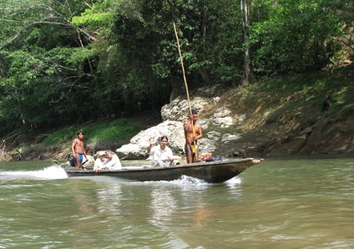
through narrow riverbeds and canyons with sheer limestone cliffs.
Doubtless many an unsuspecting
Indian in a canoe has been startled by the sudden surge in the river.
However, towards the end
of its journey to the Caribbean, the Chagres would slow down as it flowed into a giant
valley. Before the transformation of Rio Chagres, this valley
was a vast swampland that would periodically flood whenever
there was a significant rain. The valley operated as a
gigantic retention pond. Let me add this swampland was largely responsible for breeding the
massive
swarms of mosquitoes that plague Panama.
Malaria is the curse of
Panama. It is a mosquito-borne infectious disease common to
tropical and subtropical regions, including much of Sub-Saharan
Africa, Asia and the Americas.
Malaria is prevalent in
these regions because of the significant amounts of rainfall and
consistent high temperatures. The last ingredient necessary is
large pools of stagnant water. The Chagres Valley was the
perfect breeding ground. This large, flat marshland had
everything - a warm, consistent temperature, high humidity, along
with abundant stagnant waters providing mosquitoes with the
environment they need for continuous breeding
|
Gold!!
|
The
Rio Chagres has a very colorful past. That color would be the
color of gold.
Or maybe red for all the blood shed fighting over the gold.
It is likely that more gold has passed down the Chagres than any
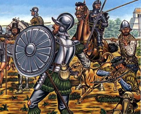
other river in the world. When the Spanish Conquistadors
looted the Incan Empire in the 1500s, the fastest way to get their
gold from Peru on the Pacific side back to Spain was across Panama
using the Chagres.
The coming of the
Spanish to the Americas was a curse of the highest magnitude for the
people who already lived there. The two words
that best described the Spanish were greed and cruelty. Death,
destruction and disease followed the Spanish wherever they went.
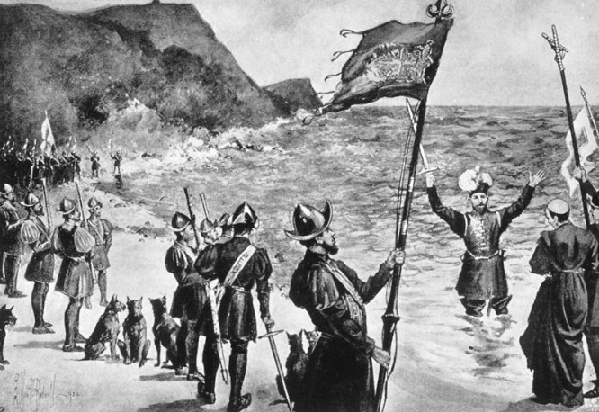
Vasco N��ez de Balboa
was a nobody farmer in northern Spain who would lead a rags to riches life.
Captivated by news of Columbus and his discovery of the New World,
Balboa joined an expedition in 1501 that
landed in Panama. There weren't enough men to take on the
hostile natives, so the expedition didn't stay long. The ship headed
back to the Spanish settlement in Hispaniola (today's Dominican
Republic).
In Hispaniola, Balboa became a pig farmer,
but not a very good one. Deep in debt, in 1509 he stowed away on a ship
headed to Panama. He hid inside a barrel with his dog. When
discovered, Balboa nearly thrown overboard by the unpopular
captain Fern�ndez de Enciso. Fortunately
Balboa was a fast talker. He was spared after claiming he knew
everything about their destination.
That was the break he needed.
During the trip, Balboa
became popular with the crew. Balboa had charisma and was
quite the storyteller. He kept the crew fascinated with tales
of what he had seen on his first visit to Panama. Plus
they liked his dog (just kidding). By the time the ship made it to
land, Balboa had somehow managed to become the unspoken leader of
the crewmen.
|
 |
|
 |
The ship landed in
Colombia at a small Spanish settlement that would someday become
modern day Cartagena. When the ship arrived, the men
discovered the settlement was virtually leaderless. A soldier named Pizarro
with no rank was in charge because the captain had been
wounded by a poison arrow and had returned to Hispaniola. The
natives were busy subjecting the few remaining Spanish to relentless
attacks.
Balboa suggested an area
he had been to that was much less dangerous. On Balboa's word,
the Spanish got
in the ship and sailed 180 miles to a place called Darien.
This location was just a few miles from today's Panama/Colombia
border.
At Darien, it was good
new/bad news. As it turned out, the natives were just as
hostile as they had been at the other place. The moment they
landed, the Spanish had to fight for their lives. The moment
they put to shore, they
encountered a force of 500 villagers armed and ready for battle.
Badly outnumbered, the Spanish won a fluke victory when the leader
panicked and headed for the jungle. His men gave up and ran
after him.
To their amazement, the Spanish discovered the villagers had left
behind a vast treasure trove of golden ornaments. The world
would never be the same.
The victory led to the founding of Santa Mar�a la Antigua del
Dari�n on the spot of their landing. As it turned out, Balboa had been right. Other
than that single tribe, this was indeed a relatively calm region.
The Spanish were finally safe. Balboa's successful gamble
earned him respect among his companions.
Meanwhile, Fern�ndez de Enciso, the
much-disliked Captain, made a serious
mistake. He kept confiscating the gold trinkets found by the
men. The men grew increasingly hostile towards the Captain whom
they considered a greedy despot.
|
|
Balboa took advantage of the situation.
Acting as the spokesman for the disgruntled settlers, while Fern�ndez de Enciso
was away, Balboa took the
position of alcalde mayor for himself. Upon his return, Fern�ndez de Enciso
did not try to get the position back when he saw the men had turned
against him. Instead he left for Hispaniola and would spend the rest of
his life trying to get Balboa arrested.
His nemesis gone, Balboa settled in.
He made sure his men were safe by defeating various tribes and befriending others.
He made sure to explore the nearby rivers, mountains, and the sickly
swamps. The men discovered the thick jungle made
further exploration both difficult and dangerous, so they never went very
far. The existence of the nearby Pacific Ocean 50 miles away remained a secret.
Balboa succeeded in
planting corn, received fresh supplies from Hispaniola,
and got his men used to life as explorers in the new territories. He
was always searching for gold and slaves and ways to enlarge his
territory. Balboa managed to collect a great deal of gold, much of
it from the ornaments worn by the native women. He obtained the rest
by violence.
Balboa, the former
stowaway, faced constant threats from visiting Spanish officials
who upon discovery of his lack of "official" authority
would threaten to
have him removed. Balboa showed an uncanny political savvy for
survival that allowed him one narrow escape after another.
Like the Old West, Balboa took advantage of his remote
location from Spanish Law.
Even his own men became
a problem. Balboa was able to quell revolts among those of his
men who challenged this authority.
As for the natives, Balboa
could be ruthless, but was basically a huge cut above the other
notable
Spanish invaders of the day. Although he had the ever-present threat of force
at his disposal, Balboa preferred to use
diplomacy and negotiation to earn respect among
the natives. Plus they feared standing up to him. An uneasy peace settled over the area.
|
 |
After three years of
settling in at Santa Maria,
Balboa felt secure enough to begin a more extensive exploration of
the surrounding areas. However, he stayed pretty close to the
Caribbean shoreline, moving along the coast but not inland. Any trips deep into the interior
of Panama were deemed too dangerous.
At the end of 1512,
Balboa arrived in a region dominated by the native leader Careta,
whom he easily defeated and then befriended. Careta was baptized and
became one of Balboa's chief allies; he ensured the survival of the
settlers by promising to supply the Spaniards with food.
Balboa then proceeded on
his journey, arriving in the lands of Careta's neighbor and rival,
native leader Ponca. Ponca immediately fled to the mountains with his people,
leaving his village open to the plundering of the Spaniards and Careta's men.
Balboa had learned a secret - he could use the natives to help
conquer other natives. While Balboa was busy using the sword
to do God's work in the New World, the Spanish Inquisition was in
full swing back home. Considering how religious Spain was, it was
truly a barbaric empire.
Days later, the
expedition arrived in the lands of the leader Comagre. This
tribe of natives were reportedly dangerous, but Balboa was received
peacefully. Preceded by his reputation, he didn't even have to
fight. Balboa was even invited to a feast in his honor; Comagre, like Careta, was then baptized.
Spreading Catholicism was lucrative business.
The Spanish, as always,
were greedy for more gold. One day a squabble broke out
between the Spaniards and the Indians. The Spaniards were
unsatisfied by the meager amounts of gold they were being allotted.
Comagre's eldest son, Panquiaco, was angered by the Spaniards' avarice.
He
knocked over the scales used to measure gold and exclaimed, "If you
are so hungry for gold that you leave your lands to cause strife in
those of others, I shall show you a province where you can quell
this hunger."
Panquiaco told them of a
kingdom to the south where people were so rich that they ate from
plates and
drank from goblets made of gold. He added with a smile
that the conquerors would need at least a thousand men to defeat the
tribes living inland and those on the coast of "the other sea."
The other sea?
What other sea?
The promise of a new
kingdom rich in gold was a major lure, but Balboa's curiosity about
the sea was an even larger motivation.
Balboa returned to Santa
Mar�a at the beginning of 1513 to get more men from Hispaniola
for a major expedition. It was then that he learned that his old
enemy Fern�ndez de Enciso had told the colonial authorities what had
happened at Santa Mar�a. Balboa was considered an outlaw.
After seeing that there would be no assistance from Hispaniola,
Balboa sent Enrique de Colmenares directly to Spain to look for
help.
Colmenares returned with two pieces of bad news. Enciso's case
was widely known in the Spanish court. Angered by Enciso's
allegations, the King was in no mood to send more men.
Therefore, Balboa had no choice but to carry out his expedition with
the few men that he had on hand in Santa Mar�a. This would be
a risky adventure.
Balboa had been told he
needed a thousand men, but he only had less than two hundred men.
However he did have several vicious bloodhounds. Yes, even the
Spanish dogs were mean. The natives had always been especially
terrified of the dogs, so he would take them along.
Balboa was undeterred by
the danger. He had waited long enough. So with just a few men
and a lot of guts, Balboa entered the interior of Panama.
Slowly but surely
Balboa fought his way through the thick jungle in search of "the
other sea". The expedition's rate of advance through the
jungle was at times only a mile a day. The rivers were swollen
during the rainy season. Numerous bridges had to be improvised from
tree trunks. Even in the sweltering jungle, the Spaniards wore
helmets and breastplates of polished steel, thick leather breeches,
woolen stockings, and thigh boots.
Heatstroke, hostile Indians, and disease began to thin their
numbers. Balboa was down to one-third of his men.
 |
On September 25, Balboa
reached a small hill along the Continental Divide. The guides
whispered to Balboa that he could see the Great Ocean from the
summit. Balboa told his men to stay and set off alone.
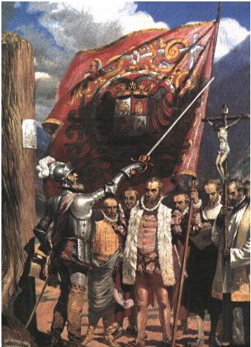
From the high point Balboa viewed the Pacific
Ocean for the first time. Only a mere 12 miles separated
Balboa from the gigantic body of water. Balboa was the first
European to ever see this amazing ocean from the Americas. At
the top, he turned one way and then the other; he could see both
oceans quite clearly.
It was now 1513.
This had to be an awe-inspiring moment for the group. However
life is full of irony. Who would ever imagine that Balboa's
greatest moment would also mark the beginning of his end?
Among the men in Balboa's group peering down upon the great ocean
was none other than Francisco Pizarro, the man who would
conquer the vast Incan Empire 20 years later. However, before his days of
glory in Peru, Pizarro would first play a hand in Balboa's death.
|
|
|
After his discovery of the Pacific Ocean, Balboa returned to
Santa Maria. From there, he sent word to the King
Ferdinand of
Spain of his amazing discovery as well as a treasure chest
full
of gold as a present to the King. Since Balboa's
discovery was almost as impressive as that of Columbus, ordinarily you
would expect the King to be pleased. Not this time.
The gold
definitely got King Ferdinand's attention, but there also
these troubling reports made by the political enemies Balboa
had incurred during his illegal rise to power in Panama.
 |
King Ferdinand
dispatched Pedrarias,
a Spanish nobleman, to
take charge in this lucrative new world.
Pedrarias was a tough guy known for his cruelty.
He landed in Panama in July 1514
along with 17 ships and 1,500 soldiers. Faced
with that kind of muscle, Balboa knew the gig was up.
His reward for discovery the Pacific was to lose his
job.
Balboa was no longer governor and mayor.
Balboa
was imprisoned as well. Fortunately, his
prestige and his fast-talking ability got him free,
but he was kept on a short leash.
Pedrarias was no
fool. Balboa was the local hero and had the loyalty of many. Pedrarias
kept a close eye on Balboa at all times. He knew as long as Balboa was around,
his own position would always be in danger in this remote
location.
Balboa
could tell he was
a marked man. For the next five years, Balboa did
everything he could to ingratiate himself with the
thug. Balboa went to the trouble of marrying one of Pedrarias' daughters, but
even that couldn't save him from
his ruthless father-in-law. Pedrarias refused to trust
Balboa's motives. He knew as long as the
popular Balboa
was around, there would always be the threat
of an insurrection.
In 1519, Pedrarias ordered Pizarro to intercept Balboa on
the way back from a mission. He gave Pizarro the
authority to execute Balboa on some trumped up charges.
It was basically a Mafia hit. There was no evidence
that Balboa was planning any coup; Pedrarias had simply
grown tired of keeping the threat around.
Balboa
lost his head. His
amazing run of good luck had run out.
|
|
|
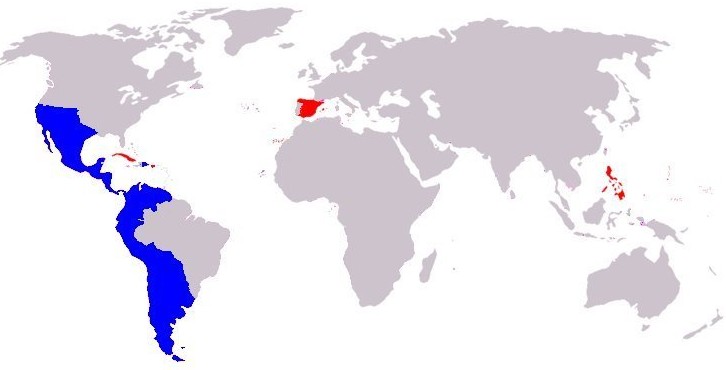
The Spanish
Empire
The first man to the New
World gets the gold.
Thanks to explorers such
as Columbus (the Americas) and Magellan (Philippines) as well as
conquistadors such as Balboa, conqueror of Panama, Cortes, conqueror
of Mexico, and Pizarro, conqueror of Peru, Spain began to acquire
incalculable amounts of wealth.
Spain would exploit the
riches of South America, Central America, and the Caribbean for the
next four centuries.
This zenith of Spanish
influence would spread Spanish blood, culture, and language to far
regions across the planet. These were the days of the mighty
Spanish Empire.
|
 |
Now it is true that the Spanish were powerful and
aggressive, but I also think they enjoyed the greatest
run of dumb luck in history. It started with Columbus.
Columbus had no idea what he was doing, completely
miscalculated the circumference of the Earth, but stumbled onto
the Americas nonetheless. That was sheer dumb luck.
He was so confused he thought he was in India of all places.
And now we celebrate Columbus Day once a year. Go
figure.
Even Balboa was
lucky. When he persuaded Fern�ndez de Enciso to move
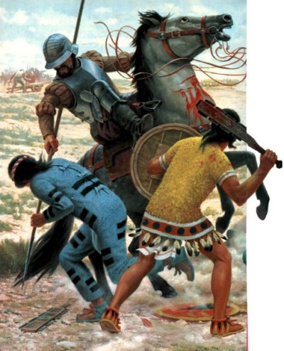
his men to Darien, 50 Spanish faced 500 armed natives.
But somehow the Spanish prevailed because the indigenous
people failed to realize that 50 guns shooting one bullet at
a time were not sufficient to stop 500 determined warriors.
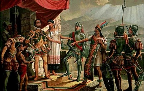
Hernan Cort�s
conquered Emperor Moctezuma and the vast Aztec empire aided
by the good fortune of being mistaken for the return of an
Aztec deity.
However, when we
speak of dumb luck, the man who takes the cake has to
Francisco Pizarro. Pizarro had the luck of taking on
the dumbest ruler in history.
Like Balboa,
Pizarro was another commoner with an uncommon amount of
ambition. Pizarro had nothing against Balboa.
Pizarro had served under Balboa in Panama for 18 years.
However, when asked by Pedrarias to take out Balboa, Pizarro was easily bought for the right price.
As reward for his part in the treachery, Pizarro was made
major of Panama City.
While at this post, Pizarro
heard rumors of vast wealth at some place called Peru 1,000
miles away. Pizarro was intrigued. Pizarro
immediately began a series of probes which seemed to bear
out the rumors.
Pizarro spent the next ten years in
various maneuvers trying to figure out what to do. He
was underfunded, undermanned, and had become
something of a renegade himself. There was a "wanted"
poster out on him. But his unrelenting ambition kept
him going.
In 1532, Pizarro
was finally close to the prize. He took on Atahualpa, the
ruler of the Incan Empire. From what I read,
Atahualpa might possibly be the dumbest ruler in history.
He paid zero attention to this new threat.
Although Atahualpa was in the middle of a civil war when
Pizarro showed up, he wasn't at all worried. And why should
he? There were fewer than 200 Spanish as opposed to
his 80,000 soldiers. That complacency was the mistake
that caused his death and doomed the Incan empire.
And just how did that happen? Basically Pizarro caught
the guy napping, but the sequence of events was so
far-fetched that I have trouble believing any of it.
The whole tale is non-stop Pizarro Bizarro.
It is also much too complicated to do in 3 million words or
less. Therefore I suggest for now we stick to our Panama
story and save that tall tale for the time we take a cruise
trip to Machu Picchu.
|
 |
|
|
|
 |
Suffice it
to say, after Pizarro miraculously succeeded in overthrowing
Atahualpa, pretty soon a vast amount of gold was suddenly
headed in the direction of Panama.
The Chagres
River is only 12 miles from the Pacific. Thanks to
Pizarro's amazing luck, overnight the Chagres became the
most important river in the world.
First the Incan
gold was shipped 1,000 miles from Peru to Panama City on
Panama's Pacific coast. From there it was transported
by mules
15 miles across the Continental Divide using El Camino Real
- the King's Highway.
At that point,
the gold was then loaded onto boats which used the
Rio Chagres to cover the remaining 40 miles to reach the
Caribbean side.
|
|
|
|
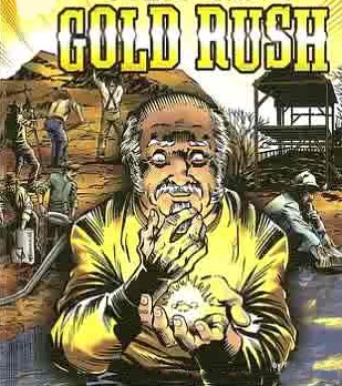
The
California Gold Rush
Strangely enough, 300
years later after the Spanish Dias de Oro, history would be repeated. The 1849 California
Gold Rush utilized the Chagres River in much the same way as Pizarro
had.
The spark that
created the bonfire were some extremely exaggerated press
reports about gold discovered in California. A
frenzied migration was triggered by the illusion that every
gold digger would automatically become a millionaire if he
could just get there in time. According to some
newspaper reports, gold was literally lying on the ground.
All a man had to do was bend down and pick it up.
There was a story circulating about a cleaning woman who
swept gold dust worth 500 dollars from a saloon floor within
a day.
Tales like these
spurred people's imagination and provided them with false
expectations. They needed to get there as fast as
possible before all that wonderful gold was gone. The fastest way
to get from New
York City to San Francisco was by boat - sail to Panama, cross the
Isthmus, then take another boat to California. Likewise, the
fastest way to transport gold back to the East Coast was
through Panama using the Chagres River.
|
 |
There are some pretty
wild stories involving Panama from that era.
In the
early days of the Gold Rush, when word of the easy
pickings reached the East Coast, thousands of men in
the East dreamed of striking it rich. And what
was the fastest way to San Jose? Through
Panama!
|
 |
So they
hopped aboard ships that dropped them off in Colon
on the Caribbean side. Then they took small
boats via the Chagres River all the way to the
Continental Divide. Then they walked a mule
path the final ten miles to Panama City to await the
next ship to San Francisco.
Except
there was one problem - There were no ships
waiting for them in Panama City.
What had
happened was that many crewmen had deserted their
jobs aboard ships the instant they reached San Francisco. They headed straight for
Sutter's Mill and other rumored
gold areas. No one in San Francisco wanted to work the ships;
like everyone else they wanted to strike it rich.
As a
result, one ship after another entered the harbor,
but didn't leave. At one point, the San
Francisco harbor was 7 ships deep in abandoned ships.
Until the captain could find someone to work for
him, they would sit there in the water like ghost
ships.
|
Meanwhile, thousands of
impatient would-be miners were stuck in
Panama City waiting for the next ship to come pick them up.
Each day when no ship showed up, these men grew increasingly
desperate. If they could just get there in time, they
would be rich! Going nowhere was driving them crazy.
Idle hands are
the Devil's workshop and Panama City was a boomtown without
a boom. Hundreds of men hung around the ticket
agencies waiting for news of steamers arriving. Still
others followed the agents around town just so no covert
actions would go unnoticed. They soon realized this
tactic didn't do a bit of good.
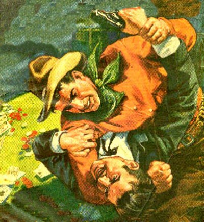
Left with
nothing else to do, the men spent their time with booze,
brawls, and brothels. There was gambling, stealing,
and constant arguing. During the day men roamed the
streets, drinking and frequenting the many gambling
establishments. Although the national pastime seemed
to be cockfighting, the gambling houses had roulette wheels,
faro banks, and monte boards to amuse everyone.
In the
early days of the Gold Rush, there was practically
no police force in Panama City. This was a
somewhat uncivilized area in the first place, so the
citizens were ill-equipped to deal with this sudden
onslaught of impatient men trapped in their city.
Panama
City was quickly overwhelmed by this endless crush
of men. These were rough men to begin with and
now they were frustrated. Some of them turned
into thugs and took their anger out on the local
citizens. They treated the locals badly, hurting the
women and beating the men in broad daylight for no
reason. For a while there, the town was in a state
of near-constant mayhem.
One day
panic broke out. A ship came in with room for
about 1,000 passengers... but there were 3,000 men
waiting. There were insufficient controls
established for who would get those spots. The
bullies shoved people out of their way in their rush
to get to the front. The people they were
pushing shoved back.
Suddenly
there was fighting everywhere - gunfights,
fistfights, and knife fights. Miners were
fighting miners. Miners were fighting
Panamanians. The riot spread through the city.
Panama City was beset by dog eat dog lawlessness.
During the riot, many stores were looted for
provisions and supplies by men whose money and
patience had run out. It was an ugly mess that
took quite a while to restore order.
The
overcrowding problem was eventually solved in a
bizarre way. Stuck in Panama for months at a
time, many of the men got sick with fever, malaria
and cholera.
|
 |
|
|
Just as the police force
was unable to cope with the roughhousing, the hospitals were not
much help either. Back in those days, there was no cure for
yellow fever. Whiskey was the main treatment. An adult
had about a 50-50 chance of survival.
Many of the would-be
miners died in Panama far from their homes. They were alone
and had no one to comfort them. In great pain and full of
fear, they died miserable deaths. Their Gold Fever had turned
into Yellow Fever.
Death by Panama Fever.
What an awful way to die. On the other hand, considering how
poorly many of these men had acted, some might say they got what
they deserved.
Meanwhile, up in the
California gold fields, many of the get-rich-quick types had
discovered it wasn't going to be as easy as they had believed,
Full of disappointment, they returned to San Francisco. Men began to
hire on ships to get them moving again. Panama City finally
returned to normalcy.
The heyday of the
Chagres River ended 6 years later. It was put out of the gold business by two railroads. First the
Old Panama
Railroad was completed in 1855. Then the USA completed its
first transcontinental railroad in 1869. From that point on, the
trains carried the gold.
Its glory days seemingly
over, the Rio Chagres returned to its role as chief waterway of
Panama. At that point, the
Chagres River should have disappeared into history as nothing more
than a footnote, but in 1880 it made a comeback when the French
began their attempt to build a canal.
Although the French
effort would fail, the Americans found a way to finally harness the
mighty Chagres River. They used the Chagres River to create the only waterway in
the entire world to directly link two great oceans.
The
construction of the Panama Canal at the turn of
the century had a real touch of irony. The same waters that
had once carried so much gold had suddenly become more valuable to
the world than gold itself.
|
 |
Trivia Question: After the French effort to build
the canal failed, the United States immediately showed
interest in a canal project of its own. There were two
major routes under consideration, one through Panama and
other Nicaragua. In 1897 and 1899 two fact finding
commissions appointed by the United States Congress
recommended the Panama route. True or False?
(answer in a moment)
|
|
STAGE TWO -
THE BIG
BATHTUB
|
This picture makes me dizzy. Do you have any idea what you are
looking at?
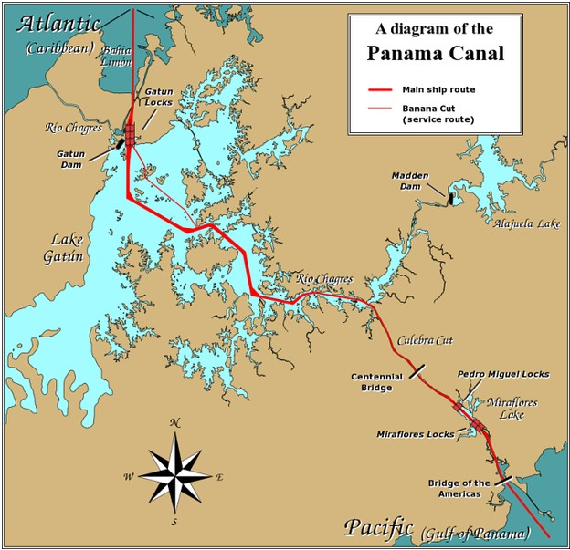
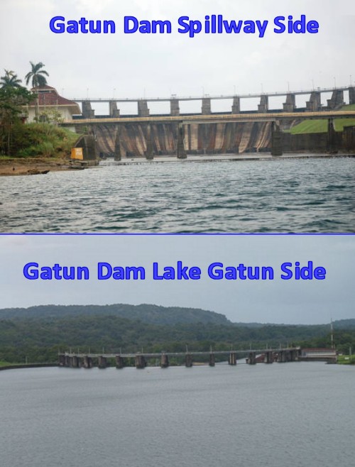
This picture is an
overhead view of the Gatun Locks (upper right corner) and the Rio
Chagres dam (center).
The earth and rubble
eventually removed from the Big Ditch would be enough to bury
Manhattan to a depth of 12 feet.
So where do you suppose
all that dirt and rock went to? The nearby Pacific Ocean?
Well, yes, some of it did. There was an island about three
miles off the coast of Panama. Using the debris to fill in the
gap, the island was connected to the mainland. The area was turned into a
thin peninsula known as the Naos Island
Breakwater.
However, they had
another very important use for the rock spoil. Every day for several years 100
trainloads of waste rock and dirt were transported 30 miles from the
Culebra Cut and deposited
into the Rio Chagres valley.
What do you suppose they
were doing?
|
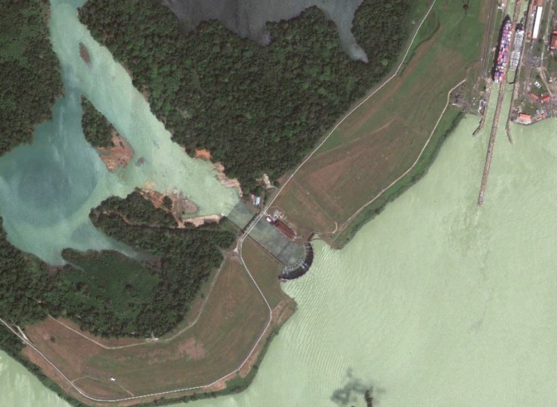 |
They were building a dam at a town called
"Gatun". Gatun was a small fishing village about six
miles inland from the Caribbean Sea that sat along the banks
of the Rio Chagres.
When people visit the Canal for the first
time, almost everybody has the same mental picture of
the Canal before their first visit -- a long narrow body of
water, twisting and turning through the jungles of Panama.
Unless they study up in advance, they
are very surprised to learn that
almost half of the Canal is just a
lake... and a very big lake
indeed!
It is time to learn about the
"The Big
Bathtub". The
man-made Gatun Lake is the amazing trick
the engineers used to finally tame the
churning waters of the
unpredictable Chagres River.
|
 |
If you remember,
the French plan was to build a sea level canal, but the
American plan was raise the waters. But what on
earth were they talking about? They were planning
to create an artificial lake.
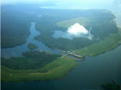
In the picture, you
can see the massive dam they put in front of the Rio
Chagres. Once the waters had nowhere to go, the entire Chagres Valley
filled up like a giant bathtub. The Chagres
River had been about 42 feet above sea level at its Gamboa bend.
Now, thanks to the dam, the river elevation reached 85 feet. They had
indeed raised the water.
The Chagres
Valley was gone never to be seen again. In its place
came Lake Gatun, the largest man-made lake in the world at
the time.
|
|
|
BEFORE |
AND AFTER |
|
Have you
ever seen a more amazing transformation?
They didn't
bother "lowering" the Rio Chagres by digging it out. Instead
they "raised" it. As you can see, by damming the
Chagres, a huge valley was transformed into an immense lake.
The new
Lake Gatun was 85 feet above sea level. That red line in the
water marks the path of the original Rio Chagres.
|
 |
The Beauty Contest
Before the
Panama Canal was built, it first had to win a beauty contest
with another proposed route in Nicaragua.
Trivia
Question: After the French effort to build the
canal failed, the United States immediately showed interest
in a canal project of its own. There were two major
routes under consideration, one through Panama and other
Nicaragua. In 1897 and 1899 two fact finding commissions
appointed by the United States Congress recommended the
Panama route. True or False?
So
what did you decide, Panama or Nicaragua? In fact,
both commissions recommended the route in Nicaragua as
superior.
|
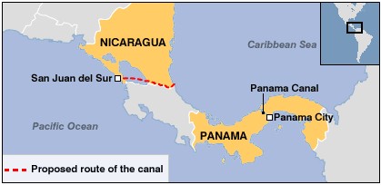 |
So what made
Nicaragua so attractive? Nicaragua had one compelling advantage.
It had a massive lake in the middle of the country.
The lake
was 107 feet above sea level, so no digging would be
necessary. Since the lake drained to the Caribbean Sea
via the San Juan River, all they had to do was dredge out
the river a bit.
To the naked eye, 90% of the route
was easy pickings. Only the hills on the Pacific side near San Juan
del Sur would present any sort of problem. But since
its lowest point was 184 feet above sea level, even this
beat Panama's Culebra Pass at 336 feet.
On the other
hand, Panama was the shorter route, but it had no lake to
use for the "lake and lock" system typically used for canals
through uneven terrain. Furthermore, its major river,
the Chagres, was difficult to control while the San Juan
River of Nicaragua was not a problem. Nicaragua had
won the beauty contest fair and square.
|
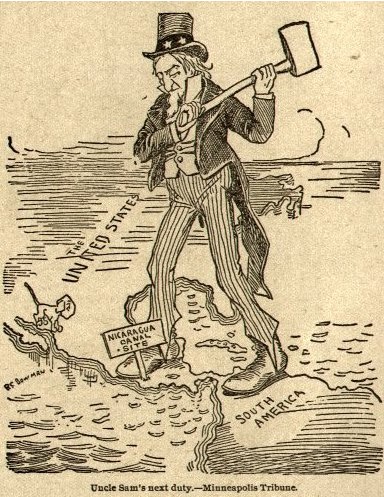
When
Teddy Roosevelt decided it was time to build a canal
in 1901, both options were put on the table.
Nicaragua had the inside track.
The
French were absolutely panic-stricken. They
had all this money sunk into their failed Panama
project. The only possible way to recoup some
of their losses would be to persuade the Americans
to change their mind about Nicaragua. France's
New Panama Canal Company began a strong lobbying
effort to influence the final verdict. The
French offered to sell its equipment and license in
Panama at a major discount.
This
offer put Panama back in the running. Yes, the
Nicaragua route was superior, but the fact that the
French had already dug out 11 of the 50 miles needed
to finish the project definitely helped to balance
the scales. The French lobbyists persuaded
Congress to pass an amendment to a bill that would
allow the President to acquire the French company's
Panama property and concessions at a cost not to
exceed $40,000,000 and to acquire from Colombia
perpetual control of a canal zone.
If the
title and an agreement with Colombia could not be
reached in a reasonable period of time, the
President was authorized to proceed with a canal at
Nicaragua.
However,
all this was contingent on a vote. Congress
had the final say-so. Even with the French
concessions, some
old southern senator had it stuck in his brain that the only
place for a canal was Nicaragua. He
wasn�t an engineer but he did have a big
mouth in the senate. He used his influence to hold up
the process.
The debate went on and on in
Congress. There were rumors that
money was secretly changing hands during the debate.
This was going to be a close
and hotly-contested vote.
|
 |
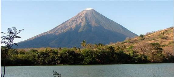 |
Then one day, a major
Nicaraguan volcano erupted
and there were
earthquakes. This
didn't help
Nicaragua's chances at all.
Volcanoes were Nicaragua's Achilles heel. This
country the size of New York had a very volatile
geology.
Known as
the Land of Lakes and Volcanoes, Nicaragua's
detractors said the geology was simply too dangerous
to risk this expensive project on. What if a
volcano erupted and seriously damaged the canal?
What if it became an ongoing problem?
Good
point. Now it was Nicaragua's turn to panic.
|
Frantic
Nicaraguan officials sent a
telegram to the US denying the eruption and earthquakes
had taken place. The southern
senator claimed his foes had made up the natural disasters. The truth was
that they didn�t. However, news traveled slowly
in those days, so the recent eruption remained more rumor
than fact.
Someone noticed
that a
popular Nicaraguan postage stamp was
engraved with a fuming volcano. One of the proponents of building
the
canal in Panama cleverly sent every
voting senator
a letter using that stamp
for postage.
When the vote
was taken, it was close, but Panama finally won by 4
votes. An
unconfirmed rumor hinted the blustering senator blew his top.
|
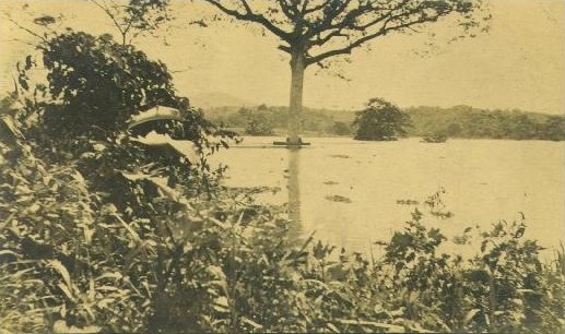
Chagres Valley Becomes Lake Gatun
|
The US engineers
breathed a huge sigh of relief when Panama was declared the
winner. By this time, all the US engineers
had decided Panama was a better choice.
For one thing, they
liked the fact that they could build on the work of the French.
Besides, Panama had a railway next to the canal site.
Nicaragua didn�t.
Furthermore, the French
had already cleared a lot of the jungle.
The clearing made it
easy to survey and measure distances. Nicaragua was still a jungle and
impossible to survey. There were simply too many unknowns
there.
On the
other hand, Panama still had its drawbacks. The
greatest difficulty of
the Panama route was how to
control the often-powerful
Chagres River and its many
tributaries. The
Chagres River rose in the
San Blas Mountains and drained a
huge basin of 1,320 square miles,
nearly half of Panama.
Controlling the Chagres was like telling the
Mississippi what to do.
The
upper section of the Chagres was a real monster
whenever it rained. However the Chagres slowed
considerably when it reached the vast
low-lying Chagres valley.
The general elevation of the valley
was
barely above sea-level.
That meant the Chagres River wasn't nearly deep enough to allow
a modern ship to cross it.
The only
solution would be to dredge a deep channel into the
Rio Chagres. But maybe not. Someone had an idea. Why not turn the
entire valley into a deep lake? Brilliant! No
digging necessary!
One of the major
factors in Nicaragua's favor had been the presence of its
massive Lake Nicaragua right in the middle of the proposed
canal route.
Yes, Panama had no lake comparable to Lake
Nicaragua, but the engineers had figured out how to
solve three headaches with just one stone. They could
tame the Chagres River and create a massive lake using the
same solution - put a dam across the Chagres in just the
right place. Plus now they had a good spot to deposit
all that excess rock and dirt from Culebra.
|
 |
|
 |
When the
engineers had originally studied the topography of Panama, they spotted
an unusual depression in the land near the Caribbean.
What could have created such an immense low spot in this
mountainous country? The features of the valley were
such that it didn't look like the Chagres River had created
it. The area was much too wide and "unsymmetrical" for
that. There was none of the usual tapering of hills
alongside the river.
That led to speculation that
the area may have been the remnants of a
volcanic crater. Many mountain lakes have formed in the cones
of dormant volcanoes.
However the
depression lacked many of the features commonly associated
with volcano craters. For one thing, volcanic craters
are elevated. This was right at sea level.
That led to
another theory that the vast Chagres Valley might be an impact crater.
In other words, a falling meteor might have created the giant
depression.
Whatever the reason, it was apparent to everyone that the terrain was
unusually well-suited to creating a reservoir. A line of hills on
all sides of the valley formed a natural
bowl.
Those hills helped make Chagres Valley a natural drainage basin. Parts of the valley
would flood whenever there was a heavy rainfall. This is what
led to marshy conditions that made this area a giant swampland.
|
 |
But why was there no lake? Because there
was one noticeable opening in the ring of hills. The Rio Chagres was nearly
a mile wide at the gap where it left the valley.
No matter how
hard it rained, the Chagres would drain the waters
through that gap. The engineers noticed that the tall hills bordering the valley of the Chagres
meant there was no possible escape for any water if that gap could
be plugged.
If they
could just find a way to close that huge gap, the geography of the area
was ideal for the creation of a large lake.
|
Unfortunately a mile-wide gap is an unusually broad span for
a dam.
If they wanted to make an
earthen dam, they would need a huge amount of dirt.
Well, we know the answer to that. Thanks to the Big
Ditch, the Big Bathtub had all the dirt it needed.
So Lake Gatun was created by a
gigantic earthen dam
designed to bridge that mile-wide gap
between the two hills.
This dam project took all that dirt and rock from the
Culebra Cut and put it to good use.
Let's see if we
can get an idea of the magnitude.
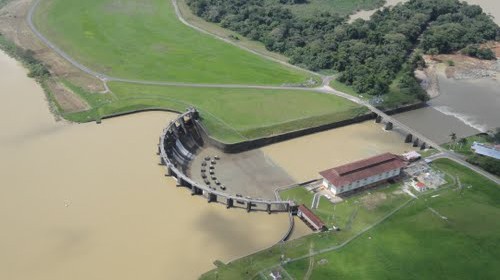
In the picture,
Lake Gatun is to the right, Rio Chagres is flowing out to
sea on the left. That entire grassy
area was added to the sides of both hills to help create the
dam. Since Gatun Dam is slightly higher than 100 feet
tall, don't forget that grassy area is not only a mile and a
half long, it is also nearly 100 feet
high. That's a lot of dirt.
Compared to other dams,
a height of 100
feet is no big deal. For example, our own Hoover
Dam has a height of 726 feet because it was built to seal a deep
canyon.
|
 |
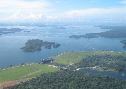 |
However, Hoover
Dam's width
is only 1,200 feet. By
comparison, Gatun Dam is 8,400 feet
wide and juts
out a half mile into the lake
at the base.
By all
standards, the completion of the immense Gatun Dam was a major project
equally as important as the excavation of the Culebra Cut.
As predicted, creating Lake Gatun
solved many problems. The raging Rio Chagres would never cause
another flood. Take a quick look at the size of Lake Gatun. Anytime it rained, the water level of the lake
would simply rise a foot or so. Big deal. Any excess would spill over
Gatun Dam and run out to sea. The mood swings of
the temperamental Rio Chagres were finally tamed.
Thanks
to the creation of Lake Gatun, the Chagres River would not have to
be dug out. The United States
had just saved
a decade of more digging that a sea-level canal would have required.
This was an immense relief since the bottom of the
Chagres was hard rock, not soft sand like the Suez Canal. After all the problems with the Big Ditch,
no one was in much of a mood to do any more digging.
|
Once the
dam was finished, the waters of the Chagres were suddenly trapped
by the giant man-made mountain.
The Chagres slowly began to fill the valley
using the waters of its 1,320-mile
watershed.
Lake Gatun was created gradually over a period
between 1908 and 1911.
When
the waters finally touched the top of the dam,
Lake Gatun had become the largest artificial lake in
existence at 164 square miles with a shore
line of 1,100 miles.
The most
important statistic about
Gatun Lake is that it now rested 85
feet above the Atlantic Ocean.
That impressive
depth was more than necessary to get the job done. A
cruise ship, for example, required 25 to 28 feet of water
depth.
85 feet was more than enough. Lake Gatun was
perfect.
So what is the largest man-made lake in the world
today? I knew you were going to ask this question, so
I looked it up.
|
 |
|
 |
Unfortunately, recent projects
have completely knocked Lake Gatun off the Top Ten list. Some dam
going up in China on the Yangtze is supposed to break all the
records. However, at the moment Lake Volta in Ghana has the record with
3,275 square miles.
That makes it about 20 times larger than Lake Gatun.
Oh well. There's always a bigger fish in the sea and
I suppose a larger
artificial lake as well. Still, Lake Gatun doesn't have to
hold its head in shame; it is just as big as some of the most famous
lakes in the world. For example, it approximates
Switzerland's Lake Geneva in size.
The Chagres Valley was
not exactly one big level area, but rather many separate valleys
with differing elevations. During the flooding process, it took several years for the rain to fill the
convoluted valleys.
|
 |
Whenever one valley filled, the trapped Chagres
water would start flooding the next lowest one.
Before
it was flooded, the Chagres Valley was a low-lying
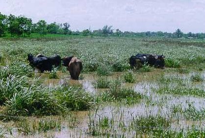
area that drained slowly whenever it rained. This
vast swampland was perfect for two things - breeding
cattle and breeding mosquitoes.
|
 |
The valley also had places that were heavily
forested.
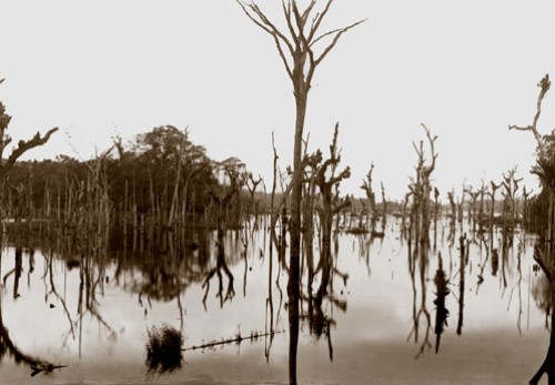
In the process of
flooding the giant valley, the waters killed off all the low-lying forest. Today
nearly a century later ancient mahogany tree trunks still tower
over the water in certain places.
In addition,
submerged stumps form hidden hazards for any small vessels that wander off
the marked channels.
|
Trees weren't the only
things buried by the water. Raising the waters 85
feet meant that all sorts of things were covered up. For
example, several sections of the Old
Panama Railroad went underwater (a new one was built as part of the
Canal construction).
The town of Gatun went under as well.
So
did many farms and native villages. Fortunately Panama was not a
crowded country back in 1900. Everyone found new
property to start over without much trouble.
Slowly but surely, the
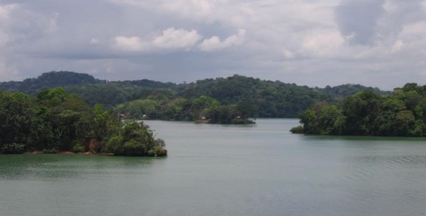
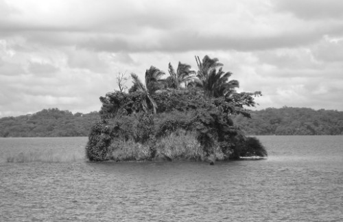
rising waters turned hills into islands.
100 foot hills became 15 foot islands. Some of Gatun's
new islands were large while others just barely poked their
nose above water. The cruise ship will pass several
of these forest-covered islands as
it crosses Lake Gatun.
Islas Brujas and Islas
Tigres are small islands which together hold a primate refuge.
Unfortunately, visitors aren't allowed.
Too many wild apes.
|
 |
 |
Since the flooding
process didn't happen overnight, the flood posed no danger for animals.
When the waters grew high enough to pose a threat, the animals
simply headed towards the nearest hill.
Not surprisingly, the
most popular hill was the widest and tallest one, Barro Colorado.
Once the animals made a new habitat there, they became permanently
trapped as the waters continued
to rise. Not that the animals minded. The island was
soon surrounded by so much water it became a sanctuary for them -
no predators could reach the place. The small animals
were safe.
Only the larger
animals like
jaguars disappeared from Barro Colorado
after the lake was flooded in 1914.
Because Barro Colorado was so isolated in the middle of the
giant lake, the island became a perfect spot for a game
preserve and a place to study nature undisturbed by the
influence of man.
That
is how Barro Colorado became
one of the world's
first biological reserves.
|
|
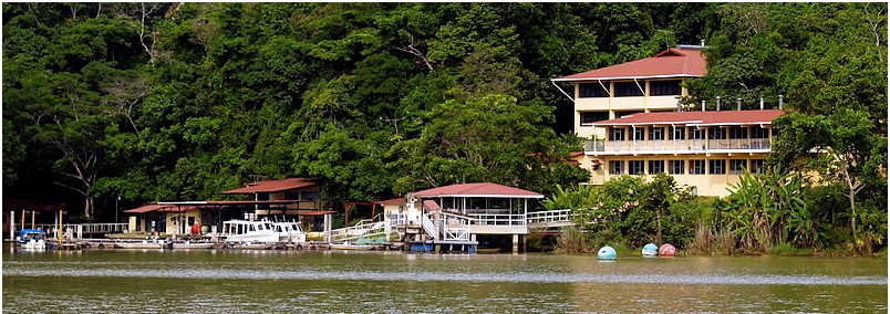
The Smithsonian Tropical Research
Institute has a permanent center on Barro Colorado island
dedicated to studying rainforest ecosystems.
Because the island's
diverse ecosystem has been little altered by humans, Barro
Colorado has been studied for over eighty years within a great
variety of biological disciplines.
Many scientific studies have been conducted
to document the changes in the species composition of the island.
|
 |
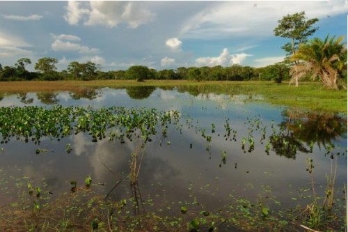
The lake itself is home to crocodiles
- swim at your own risk - as well as manatees.
The favorite fish is peacock bass, a species introduced from
South America that is popular with
fishermen. Fishing charters for bass, snook, and tarpon
can be scheduled most easily in the town of Gamboa
located at the fork where the Rio Chagres
merges with the Panama Canal.
Wouldn't it be fun if
the cruise ship would stop in the middle of Lake Gatun and let its passengers
spend the afternoon fishing for their dinner? No fish, no
dinner. Hand me a pole!
|
|