Alaska
2014
� Trip Organized by Marla Archer
� Trip Recap Written by Rick Archer
�
Published
June 2014
|
|
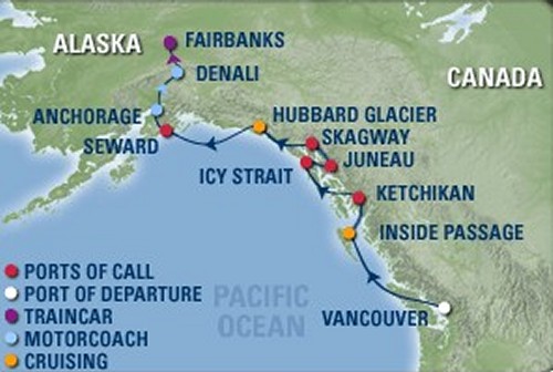
Friday,
June 13 |
Depart
Vancouver, British Columbia |
|
Saturday,
June 14 |
Inside Passage |
|
Sunday,
June
15 |
Ketchikan,
Alaska |
|
Monday,
June
16 |
Icy
Strait Point, Alaska |
|
Tuesday,
June
17 |
Juneau,
Alaska |
|
Wed.,
June
18 |
Skagway,
Alaska |
|
Thursday,
June
19 |
Hubbard
Glacier |
|
Friday, June
20 |
Disembark
Seward, Alaska |
|
Cruise Tour Extension |
|
Friday, June
20 |
Seward to Anchorage to
Denali by bus |
|
Saturday,
June 21 |
Denali
National Park, Alaska |
|
Sunday,
June
22 |
to Fairbanks,
Alaska, by train |
|
Monday,
June
23 |
return
home from Fairbanks |
|
Rick's Note: I heard this quote about
Alaska from my
tour guide:
After returning from his
first visit to Alaska in 1899, geographer Henry
Gannett cautioned his readers,
�If you are old, go
to Alaska
by all means, but if you are young, stay
away....The scenery of Alaska is so much grander
than anything else of the kind in the world...it
is not well to dull one's capacity for such
enjoyment by seeing the finest first.�
This
trip was an important landmark of sorts - this was
our 30th Cruise Trip. This is a true milestone. I applaud
my gifted wife Marla for this marvelous accomplishment.
Oddly
enough, this Alaska Trip was Marla's most difficult
trip ever. Something disconcerting is going on
behind the scenes at Royal Caribbean. Based on
the extreme wait times to get a person on the phone
(30 minutes to an hour at times), the company seems
seriously understaffed. Furthermore, there is
something wrong with their "system". Marla was
forced to correct an entire boatload of mistakes on
a daily basis.
However,
it is doubtful our 58 guests had any idea how
troublesome the walkup to this cruise was. I
give all the credit to Marla - she worked incredibly
hard to make sure all the details were properly
handled before anyone set foot on the ship. Once we
were on board, the trip went very smoothly. Marla is quite the professional.
There
were a ton of people on our cruise ship from Texas.
I can only guess that the excellent Texas economy
played a role here. In addition, there seems to be a
connection between Alaska and Texas that I can't
quite put my finger on, but it feels like the people
of both states are drawn to each other... big to
big.
I was
surprised by just how friendly the people of Alaska
were to the Texans. I expected them to frown
when I mentioned we were from Texas, but on the
contrary, the people were very nice to us.
Yes, some of them told the obligatory "Texas" joke,
but it was always with a smile. There was no sense
of rivalry.
It wasn't
always that way. As we all know, Texans are very
proud of the state size and importance. When Alaska became a state
In 1959, this immediately dumped Texas
into the second spot. At the
time, many Texans were deeply unhappy about their
state's sudden decline in status. I was 9 at
the time and keenly remember all kinds of grumbling.
Since then I have always assumed that Texas and
Alaska were unfriendly.
Until
Alaska became a state, many Alaskans were bitter
about how long it took
a long time for Alaska to become a state. It had
been over 90
years following "Seward's Folly" in 1867.
Because the media reported how unpopular
this move was with the people of Texas, perhaps the
Alaskans assumed that Texas opposed their admission
and was blocking it.
|
 |
I was
surprised to find that just the opposite was the
truth. Texas was the best friend Alaska ever
had.
Speaker of the House Sam Rayburn (from
Texas), Senator Lyndon Johnson (from Texas), and
President Dwight Eisenhower (born in Texas) all
pushed for Alaska statehood.
Of course
Alaska's cause was helped considerably by the
discovery of oil in 1957. One might say that
valuable find greased the wheels of change
considerably.
Our
Alaska
trip was special in an unusual way. We were all
looking for things you don't ordinarily see on
ocean adventures. Everyone was engaged in a spirited
search for whales, wolves, eagles, caribou, sheep,
and bears.
This was not as easy as it sounds. For example,
there were definitely whales out there in the water.
Unfortunately, unlike Seaworld's Shamu, the Alaskan
whales prefer to appear at random. Personally, after
taking a look at all the leftovers from each meal, I
think the ship should dump it all in the water and
treat us to a whale of a show. But I suppose that is
illegal.
Instead
we are all forced to just sit there staring idly out
on the water hoping and wishing. As for me, I didn't
see a thing. However, I was in the minority. Most of
our group (including Marla), did indeed have whale
sightings. I think it takes a special talent of
sorts; I don't think I am patient enough.
30 Cruise Trips is a lot of trips. Marla and I have
been at this for so long that Marla is now starting
to retrace some of her steps. For example, last year
she brought us back to Hawaii for the second time.
Our previous trip had been
Hawaii 2007. Like
Hawaii 2013,
Alaska 2014 was the same idea. We had previously
been to Alaska 9 years earlier in 2005 (Alaska
2005).
For me, this second trip to Alaska was much
different than our first trip. The main reason was
"more time". Now that I am retired, this allowed us
the flexibility to turn our one-week cruise into a
two-week visit.
First we used several days at the
front end of the trip to explore the beautiful
Vancouver area. I had absolutely no idea what
a paradise Vancouver is. It is so beautiful
and so desirable to live there, but the cost of
living is out of this world for most people.
Then
after the cruise was over, we added a four day
"Denali Extension" to our travels. More so
than any other place we visited, Denali Park
indelibly imparted the impression just how
ridiculously large Alaska is. There were vistas so broad
that they seemed endless. This became the highlight
of my trip.
Besides
the trip itself, two important events of our trip included
our visit to Vancouver and our visit to Denali. Be sure to read
my story of our trip to
Denali National Park.
As for
Vancouver, that story starts below.
Rick
Archer
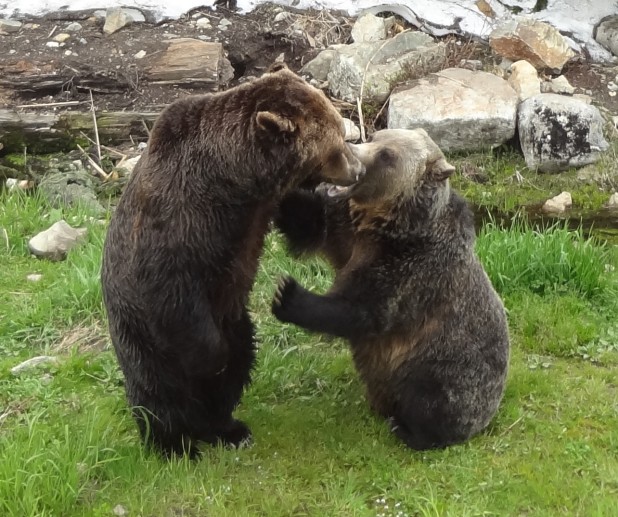
Let's
meet Coola (left) and
Grinder
(right). They are orphan bears who were
adopted by the Grouse Mountain Ski Resort.
If you see Grinder and
Coola play fighting, you can bet Grinder started it.
Grinder was found in 2001 in Invermere, BC. He was
wandering alone on a logging road, dehydrated, thin,
weak and weighing only 10 lbs. His mother was never
found so no one knows why he was in the wilderness alone.
Grinder is outgoing and high-spirited. Despite his
smaller size, he has established himself as the
dominant bear
In 2001, Coola was found orphaned on a highway near
Bella Coola, BC. His mother had been killed by a
truck. Out of three cubs, Coola was the only
one to survive. Coola is an easygoing bear who�s
content to let Grinder take the lead. Coola
can usually be found submerged up to his neck in the
large pond, carefully feeling around for his
underwater 'bath toys' - a log, large bone and
a favorite rock.
Both
bears live together in a large, very comfortable
enclosure at the resort. Marla and I had a
blast watching them play.
|
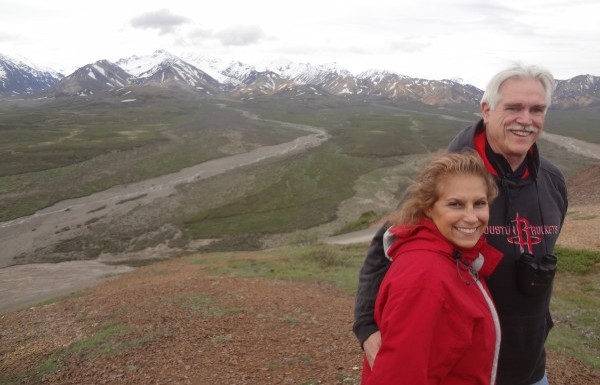
That is the magnificent "Alaska Range" in the
background along with Toklat Valley.
Marla is my hero. This was her 30th cruise
trip and definitely one of her best. However,
it took a tremendous amount of effort behind the
scenes on Marla's part to make sure this trip came
out so well.
What do you think about this picture? I think
this shot captures perfectly the incredible vastness
of Denali National Park
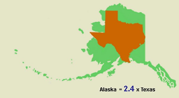
Alaska became our 49th State in January 1959.
They had to change the flag again six months later
when Hawaii became #50 in June.
The Alaskans definitely enjoy rubbing it in when it
comes to Texas. One joke is that Alaska is 3
times larger when the tide is out. Another
joke is they could cut Alaska in half and then Texas
would become the third largest state.
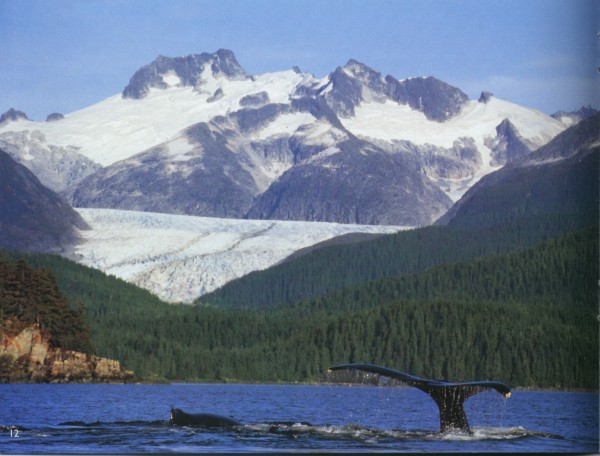
I didn't see any whales, but it wasn't for lack of
trying. Everyone else in our group was more successful.
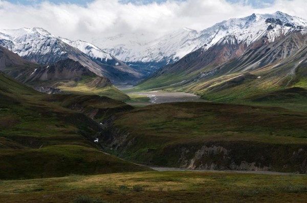
The fabled "Alaska Range" gives the State of Alaska
its name. Although this range is
relatively narrow, it extends for 400 miles.
It features Mt. Denali (not pictured) as its
centerpiece. The Alaska Range is the highest
in the world outside of Asia and the Andes.
|
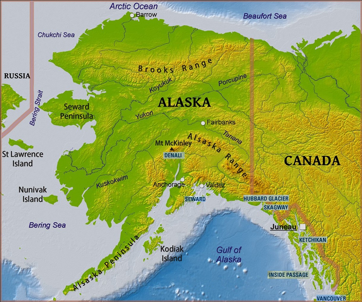
Map of Alaska courtesy of Daniel Feher,
www.freeworldmaps.net
(Original
source)
|
|
|
|
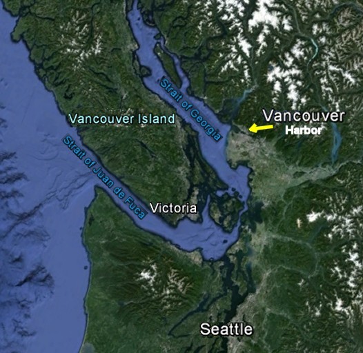
Vancouver
|
Vancouver is
Canada's most important city in the west. Together
with its sister city Victoria, the capital of British
Columbia, Vancouver is Canada's link to
Asia as well as to the western part of the United States.
Not surprisingly, Vancouver has a large Asian and Indian
population.
Vancouver has an
unbelievably safe harbor. Vancouver is protected from the
Pacific Ocean by two straits plus the huge Vancouver Island.
Like its
neighbors Seattle and Victoria, Vancouver is
protected by the Juan de Fuca Strait, a large body of
water about 95 miles long. The international boundary
between Canada and the United States runs down the center of
this outlet to the Pacific Ocean.
The Strait of
Georgia is shielded from the Pacific Ocean by
Vancouver Island. And then to top it off,
Vancouver Harbor is nestled behind a cozy inlet. The
Burrard Inlet connects the harbor to the Strait of
Georgia. At its narrowest point, it is only 500 yards
wide. The important Lion's Gate Bridge cuts
through Stanley Park to cross Burrard Inlet at this
point and connect North Vancouver to South Vancouver.
South Vancouver
is the downtown part of the city.
North Vancouver
is where much of the industrial activity takes place.
This is where most of the cargo ships load and unload.
Higher up in the hills and mountains are the premium homes
in the area.
North Vancouver
also serves as Vancouver's playground. The ski
resorts, the famous Capilano suspension bridge, and many
parks and hiking trails can be found in the mountains to the
north.
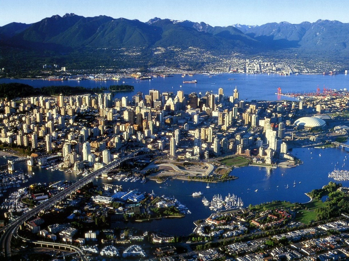
The harbor
itself is breath-taking. The beautiful mountains that
serve as the backdrop to North Vancouver make a postcard
pretty view from any spot in South Vancouver.
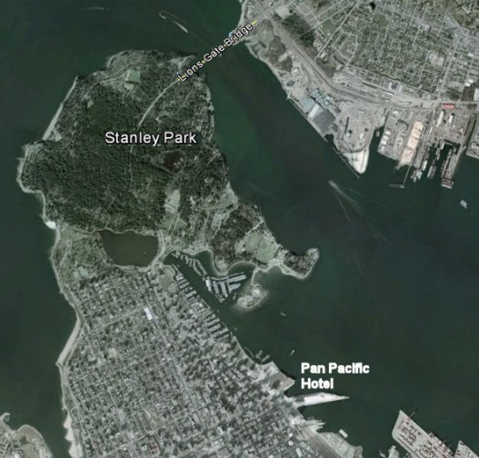
Marla decided to
splurge and put us in the high-rent Pan Pacific Hotel.
Our room was without a doubt the most expensive room we have
ever stayed in, but we both agreed it was worth the extra
cost.
Our room was
located in a corner. Thus we were able to look to the
west and see the lovely Stanley Park or look to the north
and see the incredible mountain vistas as well as the bay
before us. In addition, we both agreed we had the best
bed we have ever slept in.
A unique feature
of our hotel was that our cruise ship docked right beside
it. How fun is that? We simply called for a
bellman and he delivered our bags right to the ship below.
Then later we walked straight from our hotel to the ship.
I complained that we should have had a slide.
When one travels
from the airport to downtown Vancouver, it feels like the
downtown area is built atop an island. Thanks to a
split in the Fraser River, the taxi has to cross not
just one, but two bridges. Everywhere one looks, there
is water. This gives the impression that downtown
Vancouver is on an island. However a look at the map
above reveals the ritzy part of South Vancouver is actually
a peninsula.
Vancouver is the
most densely populated city in Canada. Urban planning in
Vancouver is characterized by high-rise residential and
mixed-use development in urban centres, as an alternative to
sprawl. New high-rises have a rule: they can't block the
view. So each high-rise is slightly larger than the one in
front and slightly shorter than the one in back which gives
a "tiered-effect" to the structures. If you
can afford a penthouse, you are guaranteed a view of the
lovely harbor.
Thanks to abundant rain, Vancouver has lush forests wherever
one looks. The city itself is incredibly green and clean.
Unfortunately, it takes a pretty penny to live in paradise.
Vancouver has the 6th most 'overpriced' real estate in the
world and is 2nd highest in North America after L.A.
On the other hand, Vancouver delivers. When you live here,
you get what you pay for: Vancouver has been ranked as
having the 4th highest quality of living of any city on
Earth. I believe it. I have seen Paris and
Barcelona. Vancouver can definitely hang with these
favorites of mine.
|
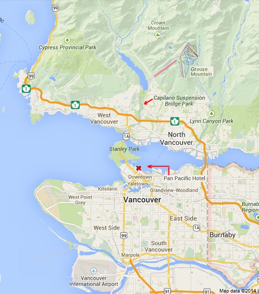
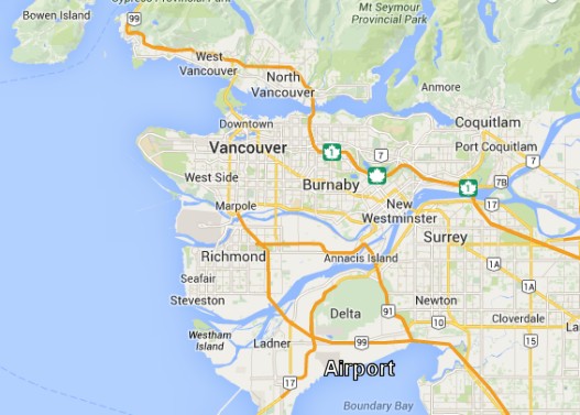
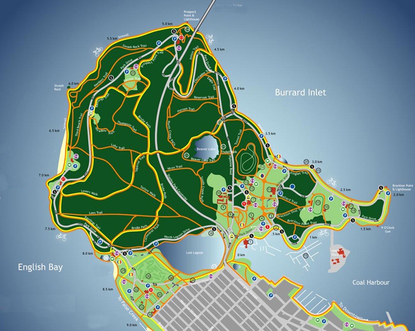
You
can use this map to orient yourself to the picture of
Vancouver below.
|
In the
picture below, Grouse Mountain Ski
Resort and Capilano Suspension Bridge are to the left of
center in those distant mountains across the bay. The
ships enter Vancouver Harbor through a narrow 600 yard wide
passage on the left. That
dark green area to the left is beautiful Stanley Park.
 |
|
|
|
Stanley
Park
|
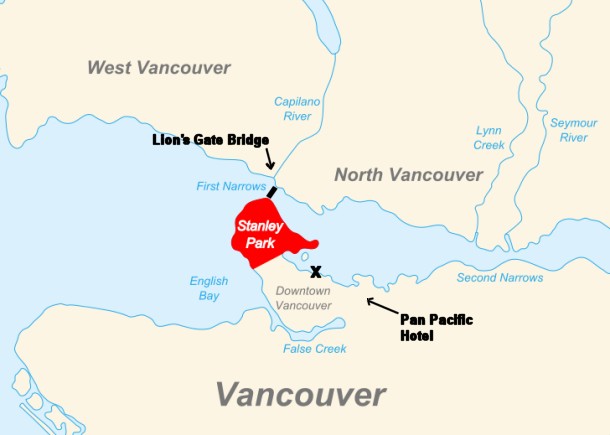 |
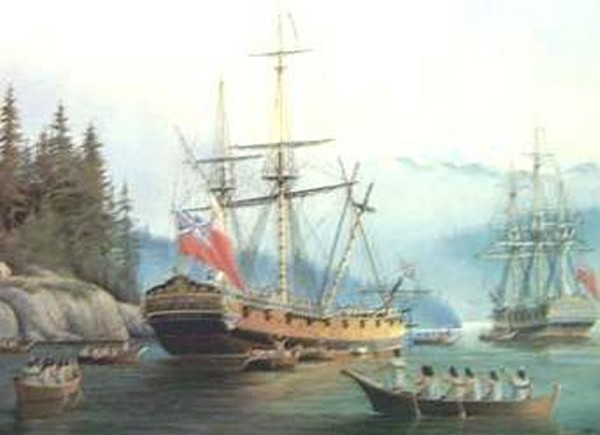
George Vancouver, the British captain credited with first
discovering the "Vancouver" area, sailed right past
Stanley Park when he came into the area now known as
Vancouver Harbor. As the map shows, Stanley Park
protects the entire harbor thanks to its unique location at
the tip of the peninsula.
In fact, this
area's value as a military base is one reason the area was
not developed during the 1800s. The military made sure
this area belonged to them. The area had some
buildings to house the soldiers, some cannon stations
overlooking the Pacific Ocean, plus a few cabins scattered
about, but that was the extent of it.
Since the first
development tended to grow up around the shipping docks much
further into the harbor, the Stanley Park area was too
remote to expand into. By the time the city had
reached its borders, someone had the sense to suggest trying
to
preserve the area rather than knock down the forest.
At 1,000 acres,
Stanley Park is very large, but not the largest urban park.
By comparison, London's Richmond Park is 2,360 acres, New
York's Central Park is 883 acres and Memorial Park here in
my hometown of Houston is 1,466 acres.
As one would
guess, the land was used by indigenous peoples for thousands
of years before British Columbia was colonized by the
British during the 1858 Fraser Canyon Gold Rush.
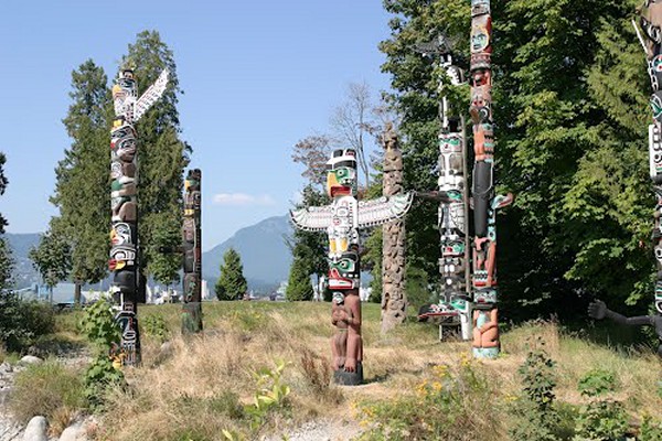
One of the nice
features about Vancouver is the long history of friendship
between the settlers and the native Indians of the area.
Canada has a highly respectful term for these people... they
are the First Nation.
Right from the
start, the British found a way to live in harmony with the
Squamish Indians. They gave them muskets and
taught them how to use the weapons. By taking
advantage of the incredible "Stanley Park" lookout point and
by working hand in hand for defense, the Squamish and the
British appear to have enjoyed an unbroken peaceful
existence together.
Today Stanley
Park gives tribute to the ongoing respect of the First
Nation with an impressive array of totem poles.
For many years
after colonization, the future park with its abundant
resources would also be home to settlers who used the area
for logging. Most of the park's trails were once
logging trails created to haul the fallen trees into the
city.
The land was
later turned into Vancouver's first park when the city
incorporated in 1886. It was named after Lord Stanley, a
British politician who had been appointed governor general.
In case that name sounds familiar, Lord Stanley's name also
graces the "Stanley Cup", the trophy given to the winner of
the National Hockey League's yearly playoffs.
Significant effort was put into constructing the
near-century-old Vancouver Seawall, which can draw thousands
of residents and visitors to the park every day. The
park also features forest trails, beaches, lakes, children's
play areas, and the Vancouver Aquarium, among many other
attractions. Additional attractions, such as the miniature
train, were added in the post-war period.
The forest
consists of primarily second and third growth and contains
many tall Douglas fir, Western Red cedar, Western Hemlock,
and Sitka Spruce trees. Since 1992, the tallest trees have
been topped and pruned by park staff for safety reasons.
Powerful winds coming in off the Pacific Ocean frequently topple the
tallest trees, so an even "skyline" is safer for all trees.
On June 18th, 2014 Stanley Park was named the �top park in the
entire world� by Trip Advisor.
One of the main
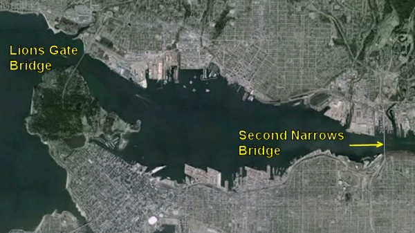
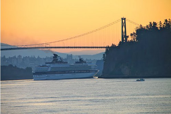
features of Stanley Park is the beautiful Lion's Gate Bridge connecting North Vancouver to South Vancouver.
As one would
expect, this vital artery led to the explosive growth of the
western end of
North Vancouver. Considering the dramatic economic
gains, one might be surprised that there was fierce
resistance at first to building the bridge.
There were a
number who argued against its construction, as many felt it
would ruin Stanley Park. Other fears would be that
unforeseen problems might crop up to interfere with the busy
seaport... e.g. ships hitting the bridge. The completion of a second bridge would also
take toll revenue away from the Second Narrows Bridge.
However, many
others saw it as necessary in order to open up development
on the North Shore and it was felt that these problems could
be overcome. The decision was put to the electorate of
Vancouver in 1927, but the first plebiscite was defeated and
the idea was put to rest for a short while.
However, as time passed, the Great Depression came along.
Noting that the building of the bridge would be a useful way
to cure massive unemployment, in December 1933, a second
plebiscite was held and passed by a 2 to 1 margin.
As one can
gather from the picture of the Celebrity cruise ship passing
under Lion's Gate Bridge, the cruise industry plays a major
part in the growth of Vancouver.
One reason that
Vancouver is absolutely ideal as a cruise port is the wealth
of interesting places for cruise passengers to visit here in
the city. I would place
"Stanley Park" as a major asset in this regard. The
distance from our Pan Pacific Hotel to the gateway to
Stanley Park was one mile. Very convenient!
If a visitor
wants a beautiful place to walk to from their hotel, you
cannot make it much easier than that. If I am
fortunate enough to visit here again - and I very much hope
I do - I would suggest renting a bicycle. The park is
large and a bike would allow a visitor the chance to circle
the entire area.
|

 |
Sometimes the time
zone changes work for you and sometimes not.
In this case,
the time zones were our friend. Thanks to the magic of
taking a plane headed west, by scheduling a morning flight
we were in our Vancouver hotel room by 1 pm.
|
This gave Marla
and me time to have a very nice outdoor lunch at a dockside
restaurant before our walk. We were halfway between our hotel and the entrance
to Stanley Park.
There was a real magic to the meal.
We were remarkably comfortable thanks to sunshine and a 70�
temperature.
We were
entertained by the variety views to choose from. The
incredible scenery included the impressive array of the
glass towers of Vancouver, the heavily forested mountains
in the distance, and the lovely bay.
From where we sat, there were several marinas. That
gave me the chance to feel a strong pang of envy as I looked
at some of the yachts in the protective cove next to us.
Maybe in the next life...
As we ate, I
noticed a veritable army of joggers, walkers, skaters and
cyclists making their pilgrimage to this oasis at the edge
of the urban jungle.
What a treat it must be to have
the incredible resource that is so easy for everyone to
reach!
|
 |
As Marla and I
made our way to Stanley Park, our path took us across a
bridge that separated the marinas from the Lost Lagoon.
Lost Lagoon turns out to be a man-made lake.
As one can see,
the Lost Lagoon is home to a large colony of ducks.
There was a sign that said this area is now a bird
sanctuary.
The Lagoon is a
traditional nesting ground to many species of birds,
including non-native Mute Swan (whose wing tendons have been
clipped to prevent escaping), Canadian geese, numerous
species of ducks such as mallard ducks and Great Blue
Herons.
I would later
see the swans as well.
I noticed
several people with binoculars and impressive cameras lining
the bridge. I take it this area is quite popular with
bird watchers.
|
 |
The red Y denotes where we ate lunch. The
pink Z
shows where the bridge is. As Marla and I made our way
across the bridge, I noticed a golf course on the other side
of the Lost Lagoon. The yellow X
shows where the golf course is located.
I was impressed
by the convenient location of the golf course. Vancouver seems to go out
of its way to make sure its playground has something for
everyone. We had
quite a few golfers in our group, so I was curious to know
if any of our friends were playing today.
I didn't have a
chance to check out the golf course, so I looked it up on
the Internet. I learned that this course is called the
Stanley Park Pitch and Putt. In other
words, it is not a 'real golf course'. On the other
hand, I noticed quite a few enthusiastic endorsements.
Here is one:
This is one of my favorite
activities in Vancouver.
The pitch and putt
course has 18 holes ranging from 40 to 100 yards. The
course definitely challenges
your short game.
Every
hole is a par 3 (they would be par 2 on a real golf
course). The variety of
the holes coupled with the challenges of trees, hills,
valleys, water traps, marshes and the occasional wasp
nest in the summer makes it
seem like a real golf course for a fraction of the
price.
Plus there
is an occasional animal sighting to keep things
interesting. We saw the coyote twice and a
raccoon walking across the fairway. They seem very
comfortable around people.
Best of all,
Stanley park is a beautiful setting. This
little golf course is exquisitely lush with abundant
vegetation. Not only is the location scenic
and beautiful to stroll around, it
furnishes some great views of
the mountains away in the distance.
From the picture, it looks like a giant "miniature golf
course".
I don't play golf myself because I hear it is both addictive
and frustrating. My nerves might not be up to a new
challenge.
I also understand
that golf can be quite time-consuming. When would I find time to write
all these stories if I played golf? That said, the pictures of this course
were very inviting. Perhaps even I could handle a course
like this and get some confidence.
|

 |
So now I turned
my attention to the public park looming before us.
Surprise Surprise.... we were immediately greeted by a "Lord
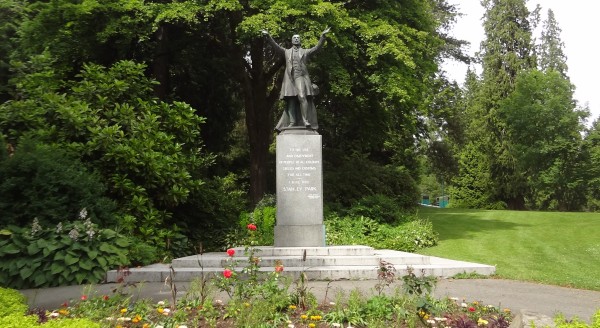
Stanley" statue welcoming us to the entrance to the park.
On every cruise
trip, Marla and I attempt to take at least one very serious
walk. Our long walks have become a source of real
pride. With that in mind, Stanley Park
presented the perfect walking opportunity for Marla and me.
The advantages
are numerous. Of course the exercise is good for our
health. That pretty much goes without saying.
But the fun part
is to wander through a beautiful part of the city
we are visiting and take in the sights at a leisurely pace.
Walking makes it much easier to take pictures and visualize
how I might describe the places we visit. Hop On-Hop
Off buses are helpful as well, but the experience isn't
quite the same.
|
 |
|
|
|
 |
There is a sentimental reason for our walks. Marla and I
have discovered we feel happier when we walk together.
We talk about everything under the sun. I would say
that long walks are the perfect setting for some of our best
conversations.
Our first-ever
serious walk during a cruise trip took place in 2004 during
Mardi Gras in New Orleans. Marla booked a cruise to
Mardi Gras because we could use the ship as a hotel, and
then continue on to Cozumel.
For anyone who has
ever experienced the insanity of Mardi Gras, I probably
don't need to explain just how fascinating it is to wander
through the crazy streets.
It is serious
fun to collect the beads thrown down from the balconies
above. And whenever I thought Marla wasn't looking, I
made sure to appreciate the generous displays of women's
breasts from the balconies. I don't think I
fooled her though. I suppose Marla just looked the other way
to keep from conking me over the head.
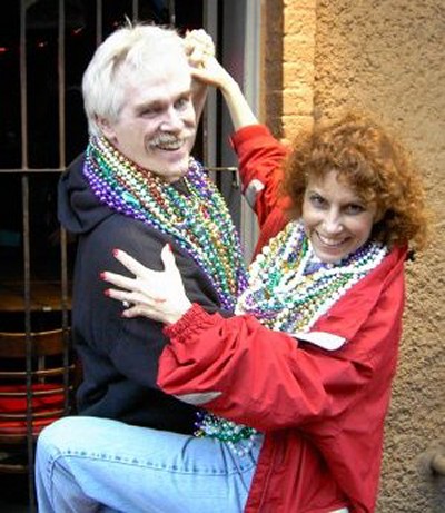
This picture is
a real favorite of mine; it brings back a great memory. As we passed a bar, we heard
some great blues music being played inside. That was
all the invitation I needed. I took Marla in my arms
and we started dancing the Whip right there on the sidewalk.
To my surprise, a crowd gathered. Soon we had a huge audience cheering for us complete with
enthusiastic wolf whistles for Marla.
Marla is normally reserved by nature. However, thanks
to margaritas and a lot of encouragement from her admirers,
Marla decided to put on a show. Marla turned her hips
loose. Oh boy! Judging from the smiles, the guys
definitely liked what they saw. Sometimes women can be
sexy even with their clothes on. Imagine that!
|
That day at Mardi Gras was a precursor to our Walking Tradition.When our cruise guests
learn about our fondness for long walks, they ask what our favorite
walk is. Marla and I agree our long walk in Rome
during the Greece 2008 Cruise was our favorite walk ever.
A friend of ours named
Cher Longoria told us that many of the sites in Rome are all within
walking distance of each other. Remembering how much we fun we
had walking through Mardi Gras, that gave us the idea to spend
the day walking through Rome. And boy did we have some
adventures!
First of all, I got
completely lost. For reasons that are impossible to explain, I
got completely turned around using this map. When we started
our day, I thought east was west. My mistake nearly cost us a
chance to visit the Borghese Museum.
Fortunately my Boy Scout
training took over. Recalling that the morning sun had to rise
in the east, at the last moment I realized we were trying to catch a
bus in the wrong direction.
So the three of us - my
daughter Sam, Marla and I - quickly crossed the street and caught
the next bus in the correct direction. Our visit to the
Borghese was a cosmic joy.
Using the Borghese as our
starting point, we headed south. Fortunately now that I had
the map figured out, it wasn't difficult at all to negotiate the
maze of streets in Rome.
In fact, it was a lot of
fun looking for the next highlight spot on the map. It was a
sort of 'hide and go seek' adventure. I had a
great time predicting that just around the corner we would see the
famous Trevi Fountain. And then sure enough, there it was!
After nearly screwing up in the morning, it was a real relief to
discover I could follow a map after all.
I was helped by the fact
that the gigantic Roman Colosseum could be seen in the distance from
practically any vantage point. It is very difficult to get
lost that way.
It turns out there are
two huge tourists traps in Rome. Believe it or not, I managed
to fall into both traps on the same day.
If you are curious, you
can read my
original
story of this day or the
abbreviated story of the day... scroll to the bottom.
Fortunately, the tourist
traps were just a silly side note to an otherwise absolutely perfect
day. There is no question that our fabulous walk through the
historical part of Rome was the start of our
Walking
Tradition.
Seeing all those famous
locations close up was quite a thrill.
|
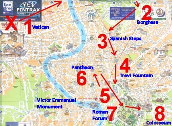
The
distance from the Borghese Gallery at the top to
the Roman Colosseum was about five miles long.
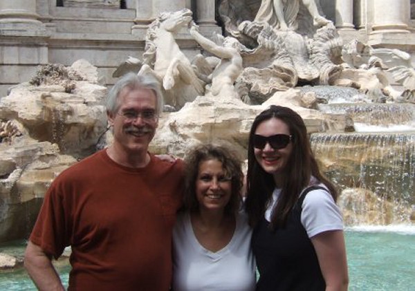
Rick,
Marla, and Sam at the Trevi Fountain in Rome
|
On a
discouraging note, not all of our walks turn out perfectly.
Assuming that
all walks in Rome are wonderful, Marla and I tried another
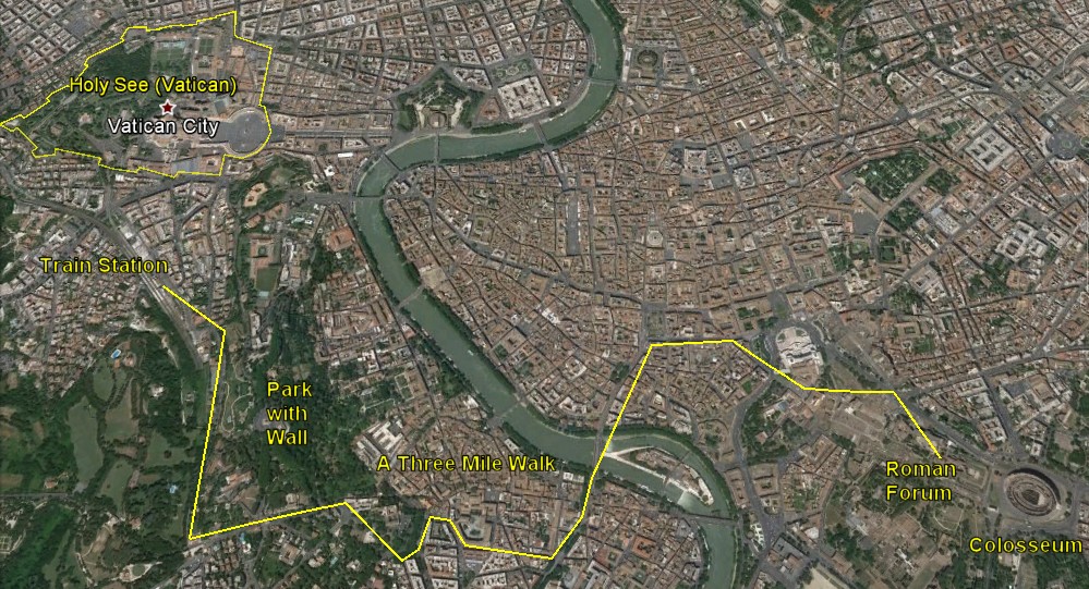
walk in Rome the following year (Barcelona 2009).
Our goal was
to walk from the train station to the Roman Forum. It
was about a three-mile walk on paper, but it became an
ordeal.
|
Unfortunately,
thanks to that same Evil Map from the year before, I nearly got the
poor woman killed... and I am not kidding either.
What
happened was that the map suggested a shortcut through a
beautiful city park. When we got to the park, we
encountered a massive wall. That wall wasn't on the
map! Now what??
The park we
wanted to cross was behind that wall on the left. Our choices were to turn
around or walk forward through the canyon-like freeway shown
in the picture. Boy did we have a fight.
Given our
limited time, we would lose an hour by backtracking, so I
insisted we go
forward. Marla said that was a freeway. Was I
out of my mind? As we debated, cars went whizzing by
at an incredible clip. Marla finally gave in, but she
was right that we were taking a huge risk. We feared for our lives the entire walk.
Marla and I agree
that our second walk in Rome
was responsible for the worst argument we have ever had.
If you are curious, read the
Evil Map of Rome.
Fortunately, the
vast majority of our walks during the cruise trips turn out
wonderfully... but not this one. I find it odd that
our favorite walk and our worst walk both took place in
Rome.
|
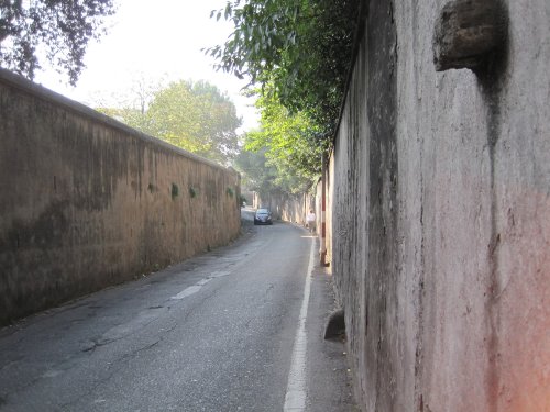
That car
was barreling down on us at 65 miles per hour!
Our "nature walk" became a half mile ordeal of sheer terror. |
|
|
Rick and Marla's Walk
at Stanley Park
|
The
bridge to Stanley Park
|
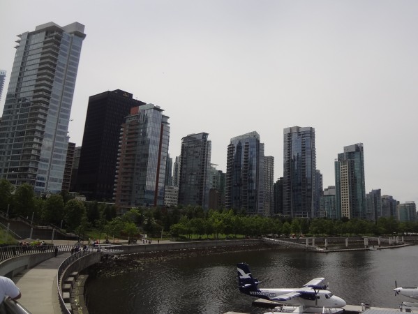
A look
at the marinas and downtown Vancouver
|
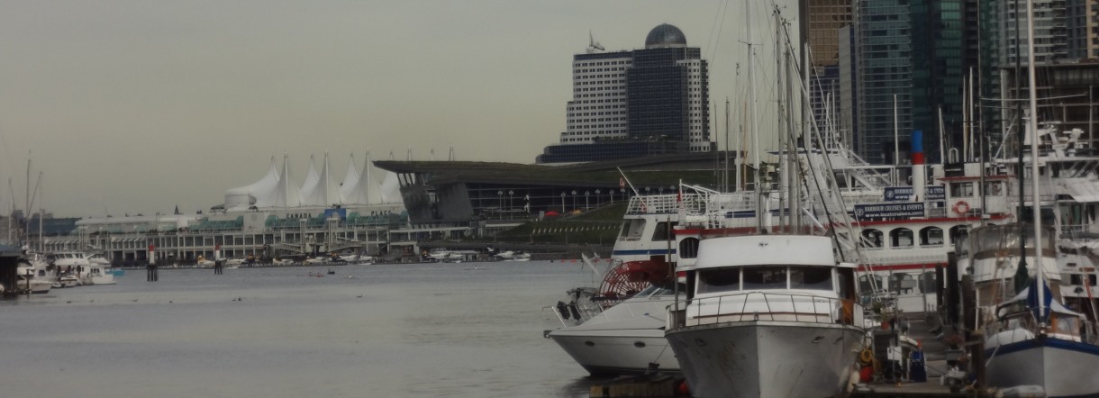
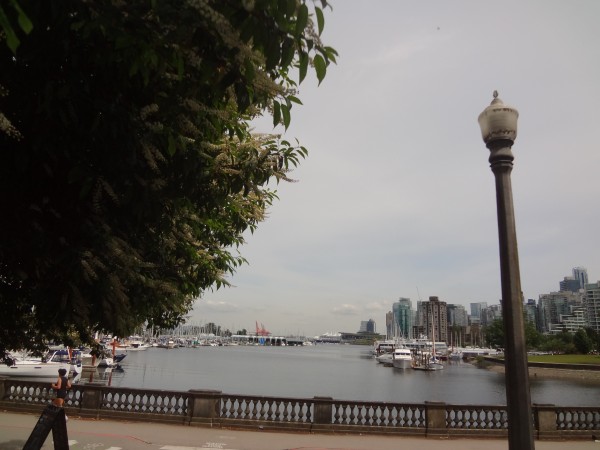
Those
sails were part of Canada Place, an area that included our
hotel. Canada Place is a building situated on the
Burrard Inlet waterfront. Canada Place is the home of
the Vancouver Convention Centre, the Pan Pacific Vancouver
Hotel, and Vancouver's World Trade Centre. The
building's exterior is covered by fabric roofs resembling
sails. Canada Place is also the main cruise ship
terminal for the region, where most of Vancouver's famous
cruises to Alaska originate.
I was
unable to gather any significance to the Five Sails. I
think they were created as decoration for the 2010 Winter
Olympics held in Vancouver.
|
 |
 |
|
|
Another look at Lord Stanley's welcome statue
|

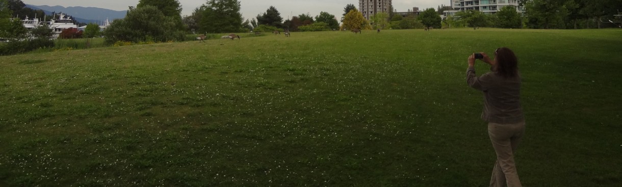
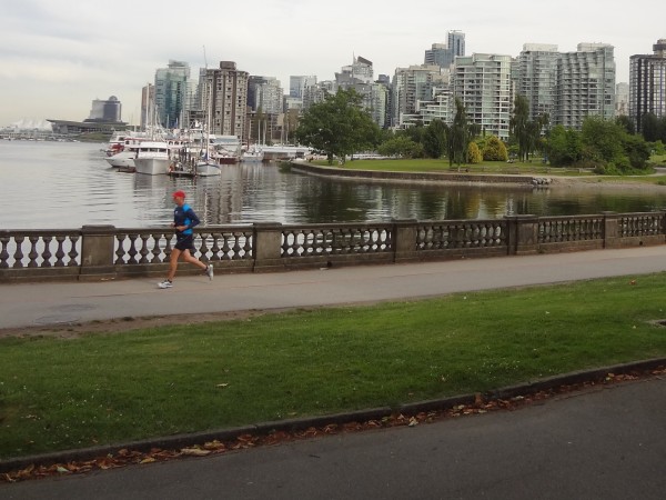
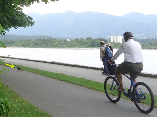
Cyclists, skaters, joggers, walkers... many people visit
here daily.
|
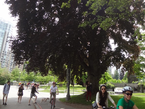
I forget to
mention lots of dogs visit here too.
|

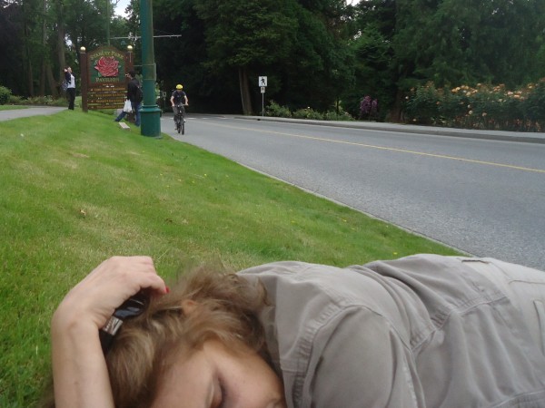
Truth be told,
we were both pretty tired from our long plane ride.
|
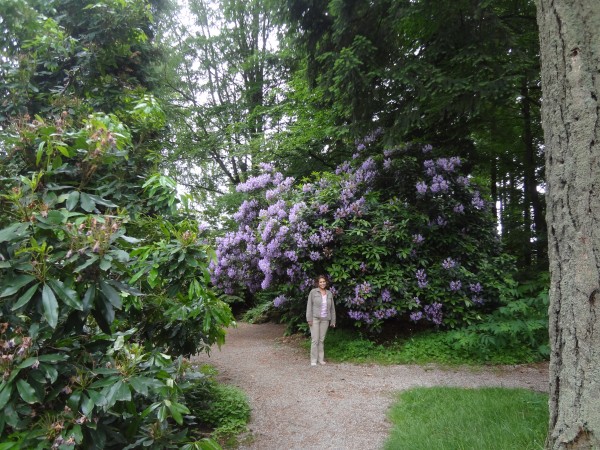
The
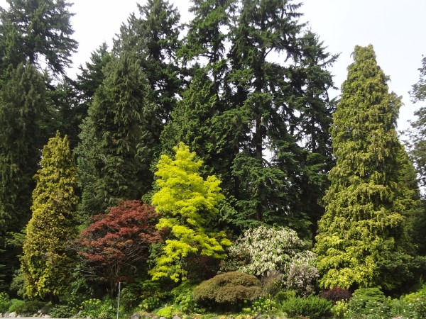
trees were just lovely. Considering this was summer, I
was surprised to see such radically different colors being
displayed.
|
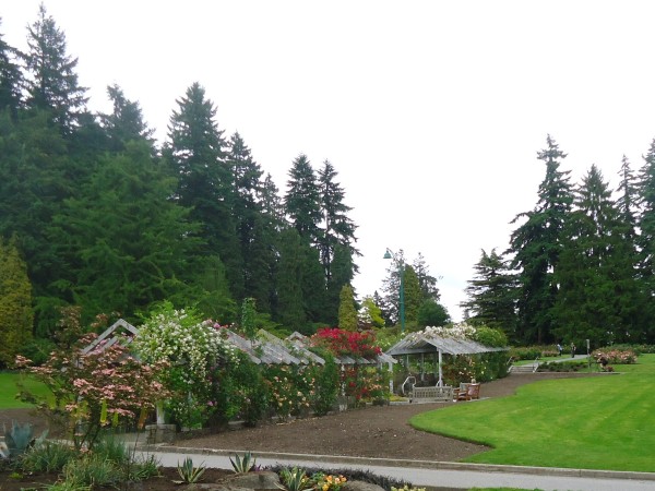
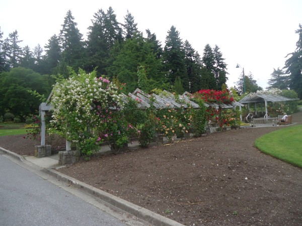
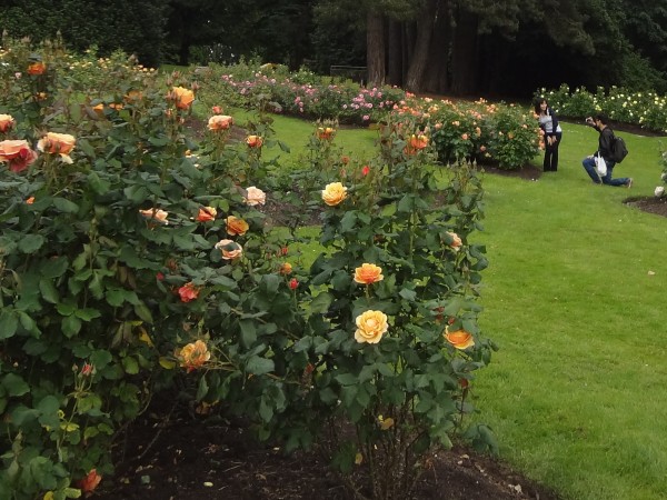
The
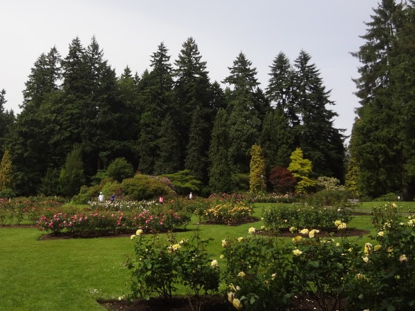
Vancouver Kiwanis Club maintains this very extensive rose
garden. I was very impressed with their job.
|
| |
|
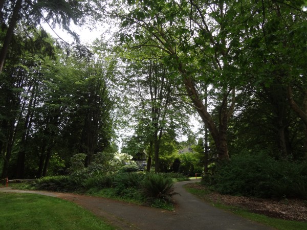
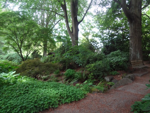
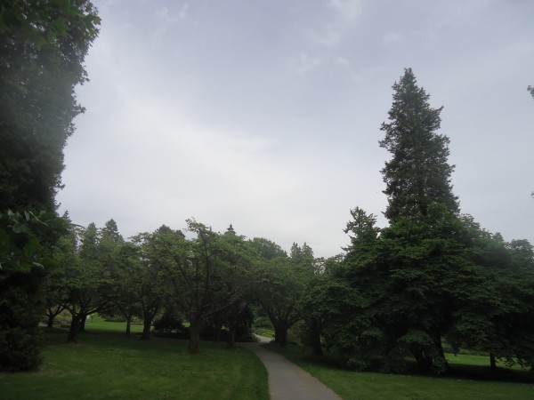
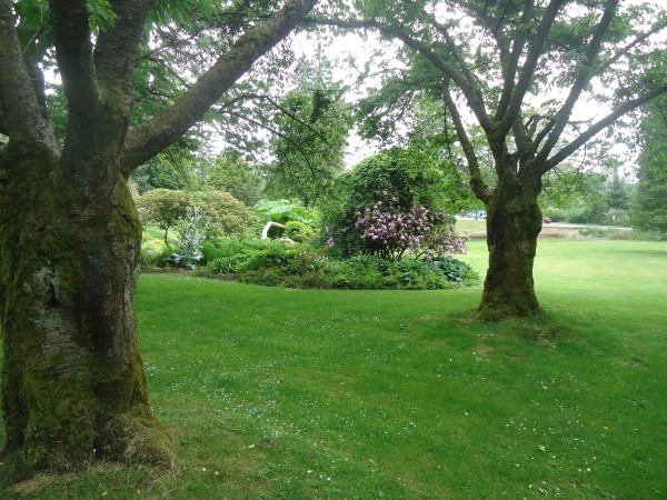
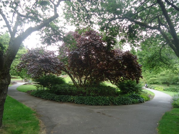
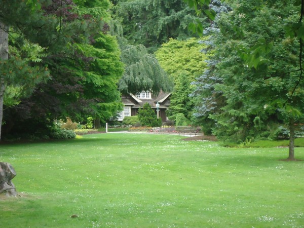
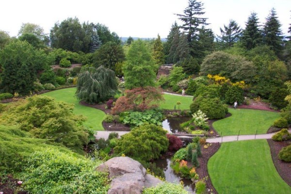
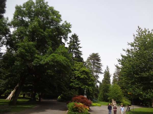
The
initial part of the park was manicured with well-maintained
paths
|
I wish
I could get my ferns to look that good
|
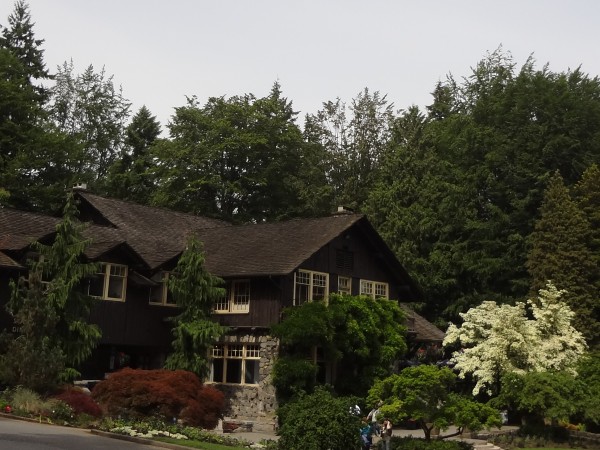
I was very
intrigued with the Stanley Inn. I could have used some water
or a cold drink for the trail ahead, but to no avail.
|
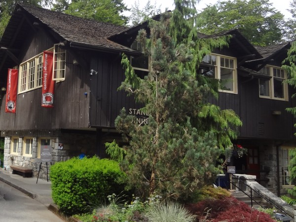
Unfortunately
the place had been rented out for a wedding reception. Try as
I might, I couldn't find an unguarded door for a peek inside.
|
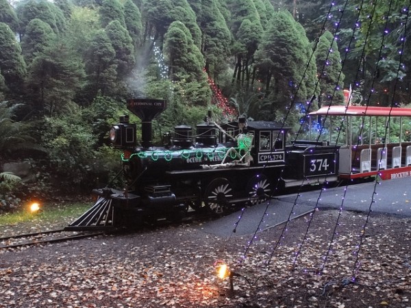
The
trolley ride. Too bad it was closed; I was tempted to
ride it!
|
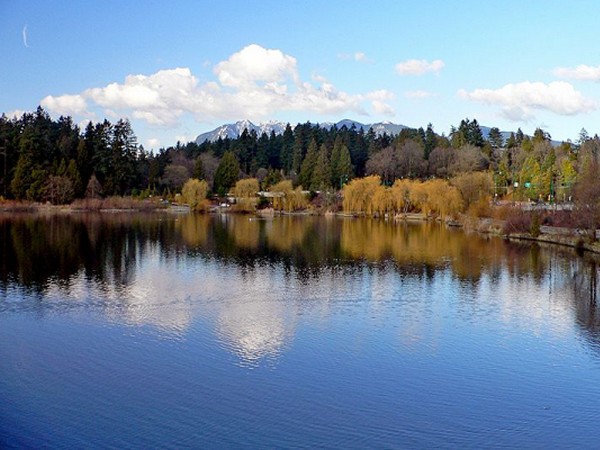
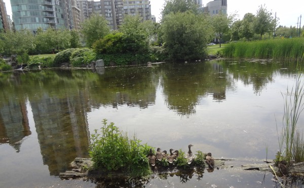
Another look at the Lost Lagoon during the Fall.
|
| |
|
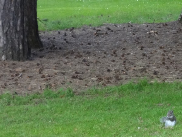
Here
is the only wildlife we saw the entire day.
|
More
wildlife
|
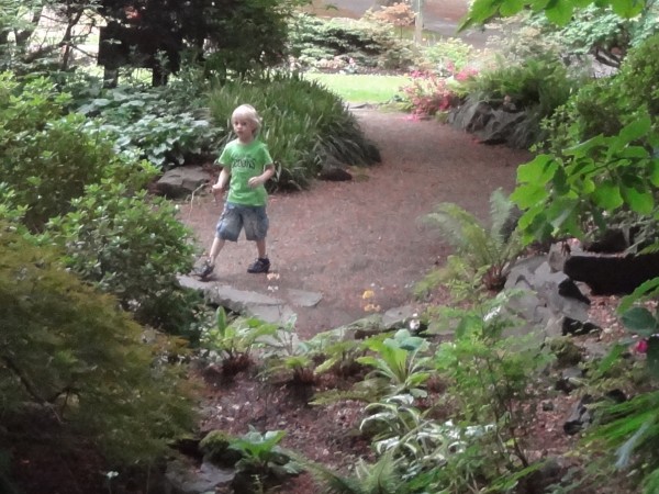
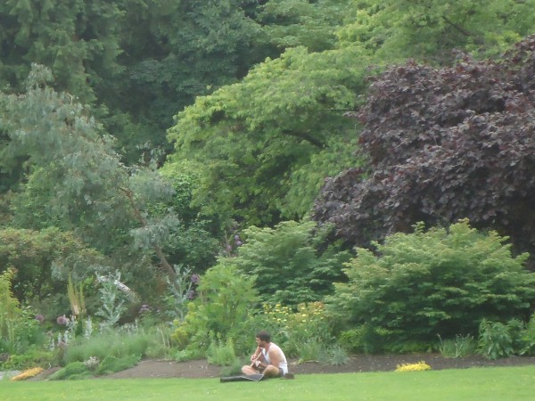
Cute
snapshot of young love.
|
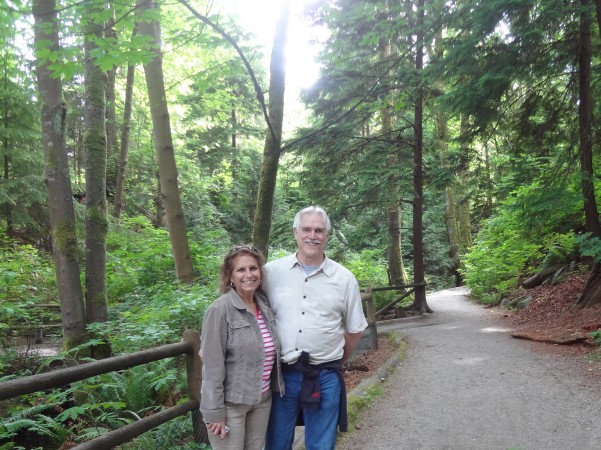
Cute
snapshot of old love.
|
 |
 |
| |
|
 |
 |
| |
|
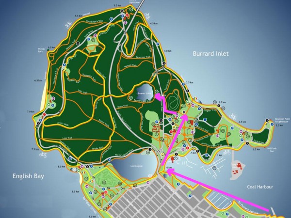
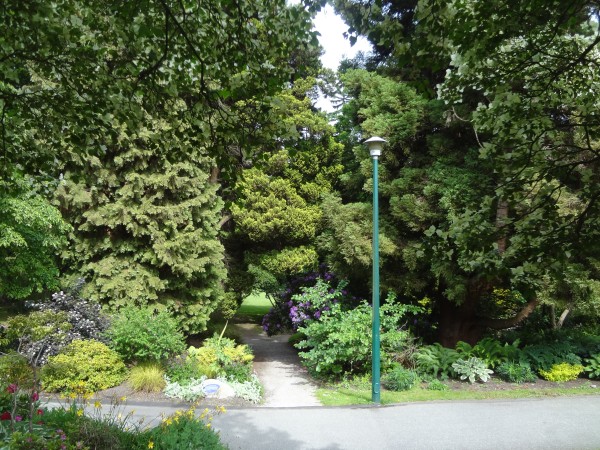
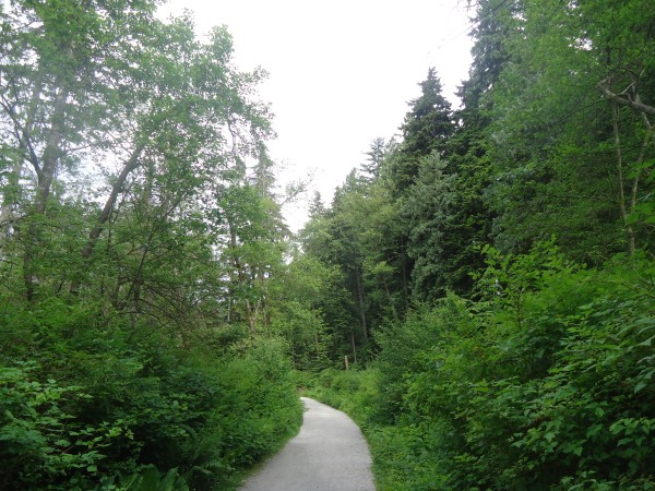
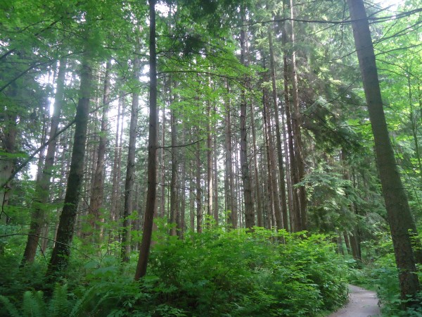
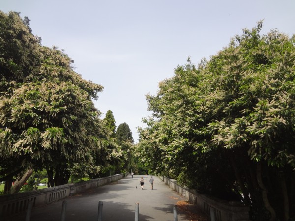
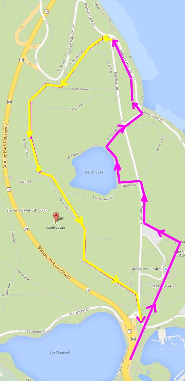
The
first part of the day's trip consisted of a mile-long walk
from the hotel along the water to the park's entrance.
The
second part entailed walking through the groomed part of the
park which included the Rose Garden and the Stanley Inn.
Now we
decided to head into a more rugged area. When we
reached Beaver Lake, this marked the end of our third
stretch.
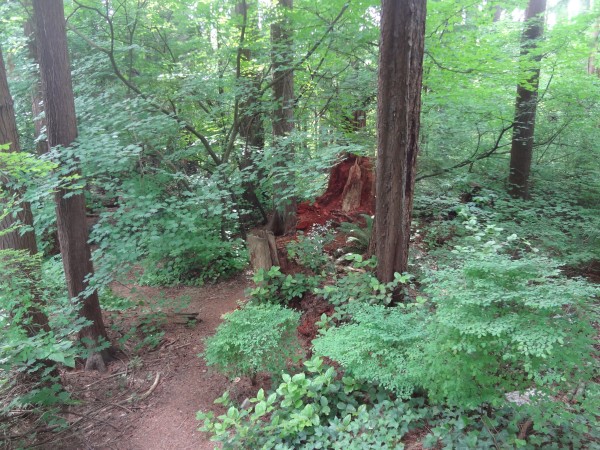
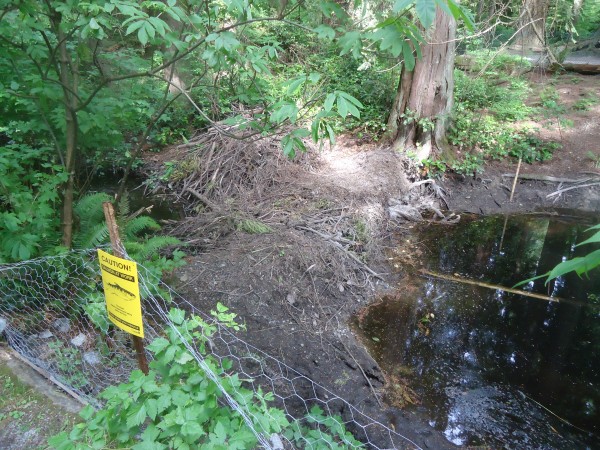
Sad to say, it turns out that Beaver Creek has big problems.
|
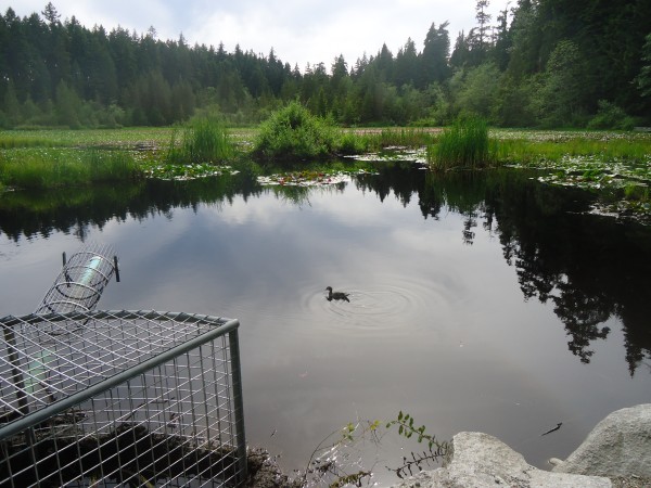
At
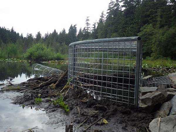
this point, our walk has taken us to Beaver Lake. Did
we see any beavers? Of course not. But we did
see a duck. So what is that strange contraption?
This was my first hint that something weird was afoot.
The sign said:
"This
beaver baffler is designed to mitigate the beaver's damming
activities and allow for adequate water flow into Beaver
Creek.
With
beavers in the lake and salmon in the creek, we are working
towards a strategy that allows coexistence with both
species."
|
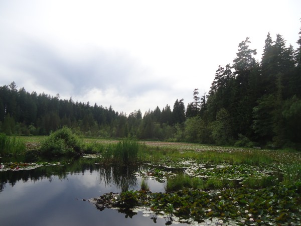
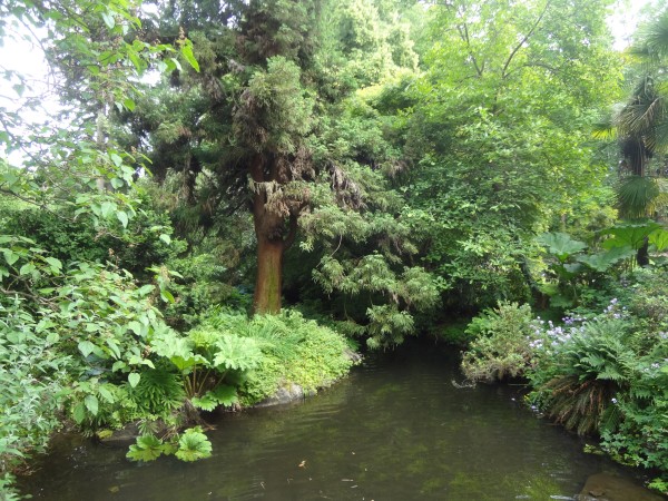
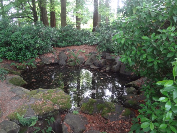
Beaver
Lake is a restful space nestled among the trees. The lake is
almost completely covered with water lilies and home to
beavers, fish, and water birds. Unfortunately, the
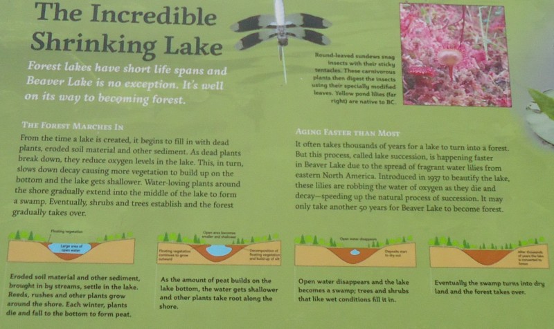
lake is slowly shrinking in size.
From an area of 17 acres in 1938, the wetland
stood just short of 10 acres in 1997. And the rate of
shrinkage is increasing. A report done in 1984 estimated that
"the lake will
fill by the year 2020�.
|
No, I
didn't take that picture; no beaver shots for me.
Beaver Creek is one of Vancouver's few remaining
free-flowing streams. Beaver Creek connects Beaver Lake to the
Pacific Ocean. It is one of two streams in Vancouver where
salmon still return to spawn each year.
The
beaver-salmon problem is simple to explain... if the beavers dam up the
creek, then the salmon cannot return to spawn.
|
Caddyshack
Revisited
Rick's Note:
Beaver
Lake is dying and the beavers are getting the blame.
Caddyshack
was a 70s movie about the crazy things that happen at a golf
course. Thanks to Rodney Dangerfield, I split a gut
whenever I watch this classic.
In the movie, there is a wonderful sub-plot involving a
gopher infestation and the insane lengths Bill Murray will
go to annihilate the damn gopher that is causing all the
problems.
So read this story and see if it doesn't remind you of
how the gopher made Bill Murray's life miserable.
|
 |
Stanley
Park�s ecosystem is being transformed, one beaver at a time
|
You could
forgive the beavers of Stanley Park for being confused.
If only, they must be wondering, those humans could make
up their minds.
On Monday, the Vancouver Park Board will vote on whether
to begin the process of restoring and enhancing the
park's Beaver Lake.
The lake, you see, has become more of a bog these days.
The report says between 1936 and 1997, the lake's
surface area has shrunk by 40 per cent.
This is blamed largely on human intervention:
The building of the Stanley Park causeway in 1938, for
instance, cut the watershed in half.
As well, there was the planting of water lilies the same
year.
As lovely as they are, those invasive lilies
along with a generous sprinkling of yellow irises have
starved the lake of oxygen, and have propelled it rather
rapidly into the bog-like state you see today.
Right now the city pumps water into the lake to keep it
from drying out completely in summer months. But
this is just a temporary solution.
In short, those plants need to go and the lake
needs to be dredged. That's what park board staff have
recommended and what the board will vote on Monday
night.
Enter the confused beavers.
Posted prominently on the lake trail is an earnestly
illustrated sign, informing visitors that the "bogging"
of the lake is a natural process, though accelerated
somewhat by the planting of those lilies and irises.
The sign declares definitively: "Forest Lakes have
short life spans, and Beaver Lake is no exception."
It goes on to describe the process by which the forest
will eventually reclaim the lake, turning it first to
bog, and then consuming it completely. The accompanying
diagrams underscore the inevitability of it all.
Unless something is done, the lake has 10 years, tops.
The sign is mounted on a beaver-proof metal pole.
Fortunately it is
placed low enough that a moderately
industrious beaver could easily read it. If they
could read, they would be worried.
Since the beavers returned to the lake in
2008, they've been looking at this sign, which spells
out in graphic detail not just how their world will end,
but when. There is no suggestion in the text that this
future can be rewritten. When it comes time to
dredge the lake, they are out of here.
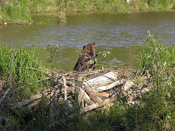
The beavers have been busy digging up lilies from the floor of the lake
and pulling
down irises.
They have been busy gnawing down saplings and dragging them to the iron bars
of the weir (dam) that maintains the level of the lake.
They have been packing the trunks and branches with mud, piling it as
high and as densely as they can.
If someone would just leave it to beaver, he would do anything to prevent the water from trickling out.
He needs that lake!
This has not gone unnoticed by the park board.
They have mixed feelings. While on the one hand
they wish they could raise the water level, they
definitely want the water to trickle out so the salmon
can spawn.
"They're frantically digging up sedimentation and
they're trying to block the drainage," park board
commissioner Loretta Woodcock told me earlier this week.
"I think they're trying to tell us something and this
board is paying attention, and we'd like to ask the
public if they agree with the resident beavers," she
said. "I think if they could talk to us they would tell
us they don't want the lake to disappear."
Actually,
what Ms. Woodcock would like to say is that she wishes
the beavers would disappear, but she can't say that.
If the beavers could talk, I'm thinking they might also
say, "Hey, why do you keep tearing down our dams? We're
trying to do the same thing here. And while you're at
it, could you please remove that wire mesh wrapped
around the tree trunks that makes it impossible for us
to chop down the trees?
"Oh, and by the way, can you get rid of that sign?
It is so depressing."
Ms. Woodcock says once the board's "extensive visioning
process" is finished, the sign may no longer apply.
"If it turns out after the visioning process, the public
say, 'Well we don't quite agree, we don't want to see
Beaver Lake disappear; we value it too much - its
aesthetic beauty and its biodiversity,' then we'll take
that sign out and we'll put something else in," she
said.
One wonders how the inevitability of nature, the
irrefutable facts presented in the sign, could be a
matter for public debate, or something to be decided on
in a vote.
But such is the power of the Vancouver Park Board.
Somewhere in this there is an lesson. About the facts
changing while the truth remains constant. Or about the
facts being altered to reveal a more convenient truth.
Or about a lake being dredged not to improve
biodiversity but to make it more appealing
aesthetically, the kind of place that tourists might appreciate more
than a bog. (source)
(Excellent
2-minute video on the beaver problem)
Rick's Note:
So after
researching the issue, I think I understand the story.
Despite the fact that this pond is called 'Beaver Lake',
there had been no beavers for 60 years.
Then one day a male beaver mysteriously showed up out of nowhere in
2008. Then later another beaver...
female... showed up. Now there is a colony of
beavers... which is amusing because the walkway along Beaver
Lake is known as "Lover's Lane". Definitely accurate.
No one knows where the beaver came
from, only that everything at Beaver Lake has changed
ever since it arrived.
Speculation is that the beaver
swam from the North Shore�s Capilano
River watershed, braving the ocean-going freighters
and strong tidal currents of First Narrows in Burrard Inlet.
As the legend
continues, when the beaver came ashore at
Stanley Park, it likely shuffled up 300
yard long Beaver Creek, dragging its paddle-sized
tail across the slippery cobbles, before reaching the
water�s source � Beaver Lake.
Personally,
I want to know why doesn't anyone suspect a human was responsible.
That seems like a very obvious possibility.
Well, as they say,
it is all water under the Lion's Gate Bridge. That was back in 2008
and now we have the lake�s first resident beaver in 60 years.
Ever since, the rodent has been
locked in a war of wills with park officials.
At this point, every tree in the area has wire mesh around
the bottom. Why? The park officials don't want
the beaver killing their precious trees.
Furthermore, every time the
beavers build some sort of dam, a park official comes over
and destroys it.
Meanwhile, the
salmon are having fits thanks to the beavers. Their
"Beaver Creek" can go as low as one foot deep.
In other words, the
lake is dying fast and the beavers aren't helping. Everyone
agrees these wetlands need to be preserved. Wildlife
surveys show that many winged species that depend on it,
from ducks, geese, herons, and eagles to small birds like
sparrows... after all, we all know that Beaver Lake is the
ONLY lake in all of Canada where this activity can possibly
take place.
The lake also hosts several types of aquatic fish and
reptiles,
including frogs, salamanders, turtles, and sticklebacks.
Currently coho salmon are also present in the streams fed by
the lake and more would come if the damn beavers would just stop
damming up their spawning grounds.
In other words, these wetlands are important as a habitat
for wildlife. If the lake disappears, so will these
animals.
The very survival of all birds and fish in Canada
seem to depend on this single spot.
And what is the
best way to preserve the lake? Get rid of the pretty
lillies, get rid of the beavers, and dredge the bottom.
If they make the lake deeper, it will survive a bit longer.
The only problem
is that no one has the guts to shoot the beavers. Except for the deer and bear hunters, the Vancouver people can't bear to hurt a
single living thing.
To do so would be to admit
that no human is smart enough to beat the beavers at their
own game.
So they invent 'beaver bafflers' and hold
town meetings every two months to look for solutions. They want to have their lake and keep their beavers too...
and their salmon... and their trees.
Even Paradise
has its problems. I have a solution - hire Bill
Murray. He will know what to do.
|
"Caution: Salmon at work. This stream supports
spawning and rearing salmon and trout. Please protect
this resource."
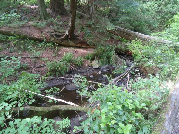
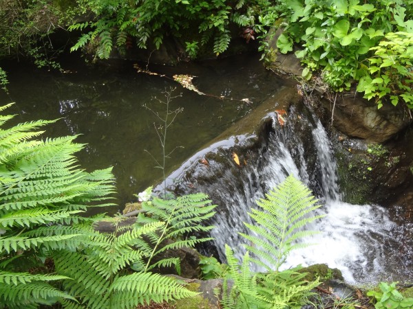
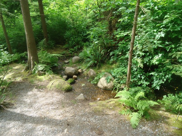
Here
is a good look at the 300-yard Beaver Creek.
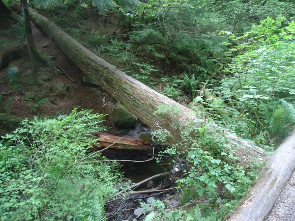
I
estimate a depth of one foot.
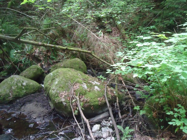
Sad to
say, but little Beaver Creek is barely more than a trickle.
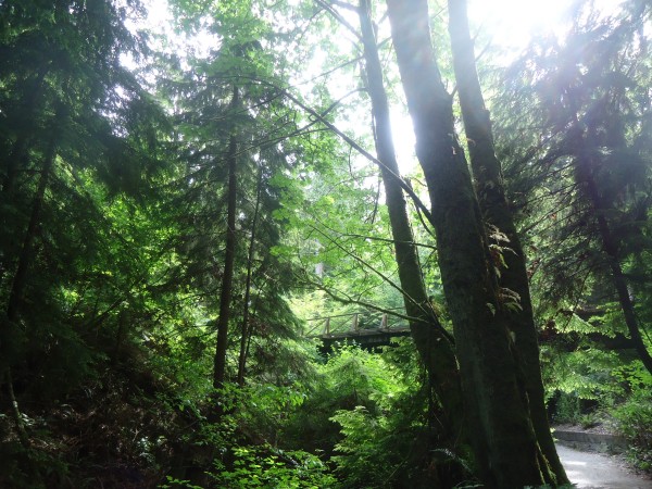
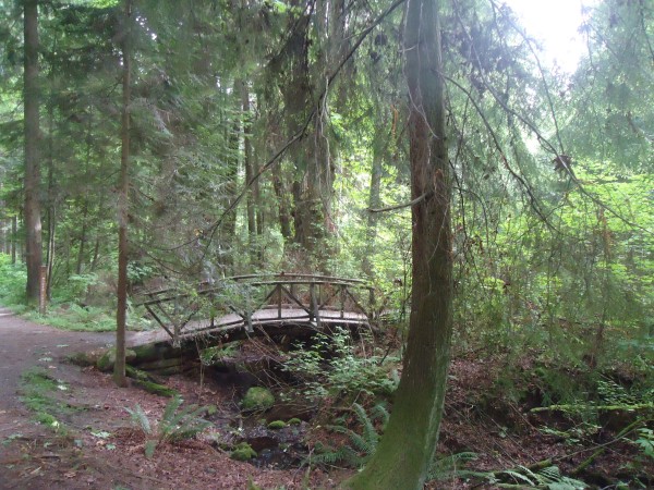
Ravine
Trail
follows Beaver Creek down to Burrard Inlet
To understand this picture, the beavers
have built all this mud up to trap the lake water from
leaving. And the park ranger has installed this
contraption designed to let the water escape.
The
Beaver
Baffler is designed to manage the beavers� natural instinct
to dam the water flowing from the lake into Beaver Creek.
Everyone knows that beavers like to build dams and the
family in Beaver Lake is no exception. Damming expands the
area of the lake they call home to create more habitat for
their favorite foods: willow and alder trees. Damming also
makes the water deeper, which can prevent the lake they live
in from completely freezing in winter.
However, when the beavers in Stanley Park block the outflow
from Beaver Lake, it stops vital water from flowing to
Beaver Creek, which is a spawning stream for coho salmon and
cutthroat trout - a �species of special concern� in BC.
This is bad news.
The
Beaver
Baffler
is cunningly designed to stop this from happening. The
baffler is set up so the beaver can�t sense where the water
outflow is, although they will be able to hear the flowing
water. It�s this noise that stimulates the beavers to begin
damming.
So the next time you visit the lake, look
for a mud �wall� built up by the beavers against the wire
fencing. They can no longer reach the lake outflow, and
pipes beneath the water�s surface continue to direct water
into Beaver Creek.
|
|
|
(Rick's Note:
Believe it or not, this crazy Beaver Lake story is not my first
story about a beaver dam. I wrote another crazy story about
an arrogant government agency brought to its knees by a
clever Michigan man. You have to read it to believe it.)
The Infamous
Beaver Dam Dispute
|
|
|
|
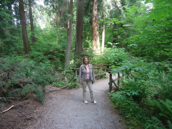
One
last picture of Marla before we emerge from the forest.
|
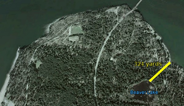
Aha!
We have finished our 300 yard walk from Beaver Lake.
|
So
what is going on with that bird? He has just
caught something. Look for the little dark spot.
|

He
brought some sort of shell from the water, but he can't eat it because no one will leave him alone.
|
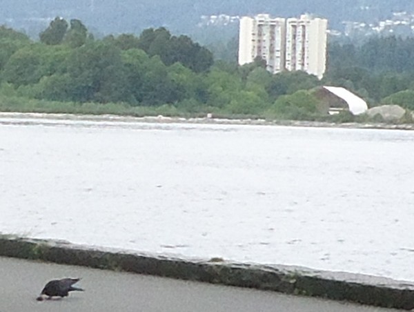
Finally a moment of peace. The bird has caught a clam
or something in the water. Now that the girl has
passed, the bird resumed trying to penetrate the shell.
Pretty exciting, huh?
|
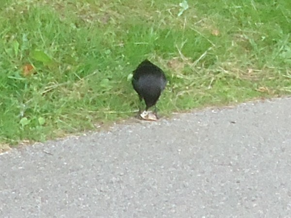
The bird has finally shattered the
shell and is rewarded with a meal. Meanwhile Marla
tells me to wrap it up for crying out loud. She just
doesn't understand, does she? This is a true Disney
moment.
|
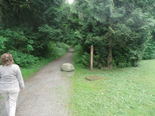
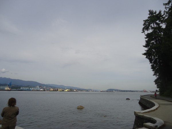
After walking
the seawall for awhile, we realize we don't have the stamina to walk
to the far end of Stanley Park. So here we decide to head back
into the forest at Chickadee Trail. Time to head for home
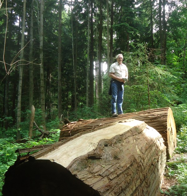
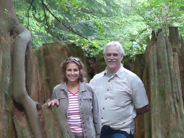
Those massive
trees were five feet in diameter. I am trying to look like
Paul Bunyan in his prime, but it was serious work to get up there.
|
 |
|
|
|
I
wandered around for a bit taking pictures. Marla said
if I wanted to take some pictures, then she was going to
take a little rest. When I returned, Marla was sound
asleep.
|
We had
a great day, but we were both seriously worn out.
Rather than end the day in dramatic triumph, we kind of
dragged our way back to the hotel. But you know what?
It was worth it.
|
|